Perseverance Rover Captures Striking Panorama of Ancient Martian River Valley
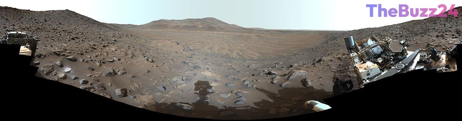
The Perseverance rover has captured a comprehensive 360-degree vista of Neretva Vallis, offering scientists an unprecedented look at a region that once featured a flowing river channel. The sweeping panorama was meticulously assembled from 217 individual images captured by the rover’s advanced Mastcam-Z instrument.
Captured on May 20, 2024, corresponding to the 1,155th Martian day of the mission, the view highlights the wind-swept, dusty terrain characterizing the area today. Planetary scientists note that billions of years ago, this very location served as an active river system carrying fresh water into the Jezero Crater, a key target in the ongoing search for ancient microbial life.
The released imagery underwent specialized processing to enhance visual contrast and accentuate subtle color variations across the landscape. The Mastcam-Z instrument operations are directed by academic and research institutions, while the Jet Propulsion Laboratory oversees the broader engineering and mission operations for the Perseverance rover.
Key Takeaways
- Perseverance captured a 360-degree view of Neretva Vallis using its Mastcam-Z instrument.
- The panoramic image was stitched together from 217 individual photos taken on the 1,155th Martian day.
- The landscape was once an ancient river channel that fed water into Jezero Crater billions of years ago.
Editor’s Analysis & Impact
The ongoing documentation of Neretva Vallis by the Perseverance rover marks a significant milestone in planetary geology and our understanding of Mars’ climatic history. By providing high-resolution, enhanced-color panoramas of ancient river systems, the mission continues to refine models of early Martian hydrology. These observations are crucial for selecting high-priority sampling sites that may hold biosignatures, ultimately shaping the trajectory of future astrobiology research and potential sample-return architectures. As the rover navigates these complex terrains, the technological reliability of instruments like Mastcam-Z underscores the viability of long-duration robotic reconnaissance, setting a robust precedent for subsequent interplanetary exploration initiatives.
Frequently Asked Questions
Q: What is Neretva Vallis?
A: Neretva Vallis is a region within Mars’ Jezero Crater that scientists believe was once an ancient river channel, which fed fresh water into the crater billions of years ago.
Q: How was the 360-degree panorama created?
A: The panorama was stitched together from 217 individual images captured by the Perseverance rover's Mastcam-Z instrument on the 1,155th Martian day of the mission.
Q: Why are images of Neretva Vallis important for scientists?
A: These images help researchers study the ancient geological and hydrological history of Mars, assisting in the search for potential past microbial life.
AI Disclosure: This article is based on verified data and official reports. Our Team and AI have cross-referenced every financial detail with primary sources to ensure total accuracy.
More from this Category