Lunar Far Side Revealed: High-Resolution Imagery Unlocks Ancient Geological Secrets
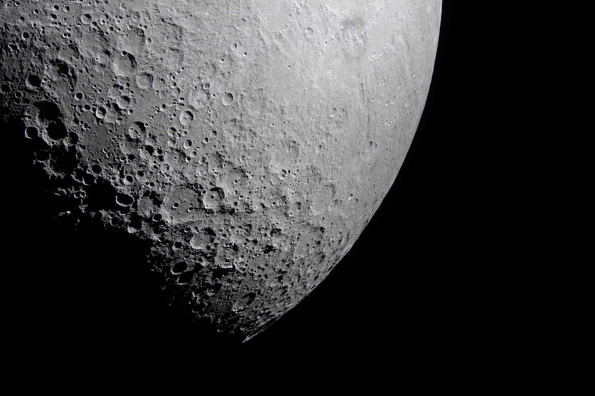
Researchers have unveiled a series of high-resolution images of the Moon’s far side, captured on April 6, 2026, providing an unprecedented look at the satellite’s rugged terrain. By focusing on the lunar terminator—the transition zone between day and night—the imagery utilizes long, dramatic shadows to highlight surface textures that are typically washed out by direct sunlight. This strategic lighting has acted as a natural geological filter, enabling scientists to map topographic features that were previously hidden from view.
A central highlight of the new data is the detailed capture of the Orientale Basin. The low-angle illumination has allowed experts to trace the basin’s complex structural framework, offering new insights into the massive impact events that shaped the lunar crust billions of years ago. This level of granular detail is expected to significantly refine existing scientific models regarding the Moon’s long-term evolution and geological history.
These findings serve as a critical milestone for the Artemis II mission, which continues to advance the capabilities required for deep-space exploration. The data collected is being integrated into a comprehensive mapping database, which is considered an essential prerequisite for future human-led lunar expeditions. As international interest in space exploration grows, these high-resolution maps are laying the groundwork for a sustained human presence on the lunar surface.
Key Takeaways
- New high-resolution imagery of the Moon's far side was captured using the lunar terminator to highlight surface textures.
- The Orientale Basin was mapped in unprecedented detail, providing insights into ancient lunar impact events.
- The data is a vital component of the Artemis II mission, supporting the development of maps for future human lunar exploration.
Editor’s Analysis & Impact
The release of this high-resolution lunar data marks a significant step forward in planetary science and mission planning. By utilizing the lunar terminator to enhance topographic visibility, researchers have effectively bypassed the limitations of traditional direct-sunlight imaging. From an industry perspective, this success underscores the increasing importance of high-fidelity mapping for the burgeoning lunar economy. As private and public entities look toward establishing permanent lunar bases, the ability to accurately identify geological hazards and resource-rich sites becomes paramount. This mission not only deepens our understanding of the Moon’s ancient history but also provides the foundational infrastructure necessary for the next era of human spaceflight. The integration of this data into global databases will likely accelerate the timeline for sustainable lunar habitation and long-term deep-space logistics.
Frequently Asked Questions
Q: Why is the lunar terminator important for imaging?
A: The lunar terminator is the boundary between day and night on the Moon. At this location, the sun is at a low angle, creating long shadows that highlight surface textures and topographic details that would otherwise be invisible under direct, overhead sunlight.
Q: How does this data support the Artemis II mission?
A: The data provides a comprehensive mapping database that is essential for planning future human-led expeditions, helping scientists and engineers understand the lunar surface's composition and structural history.
AI Disclosure: This article is based on verified data and official reports. Our AI have cross-referenced every financial detail with primary sources to ensure total accuracy.
More from this Category