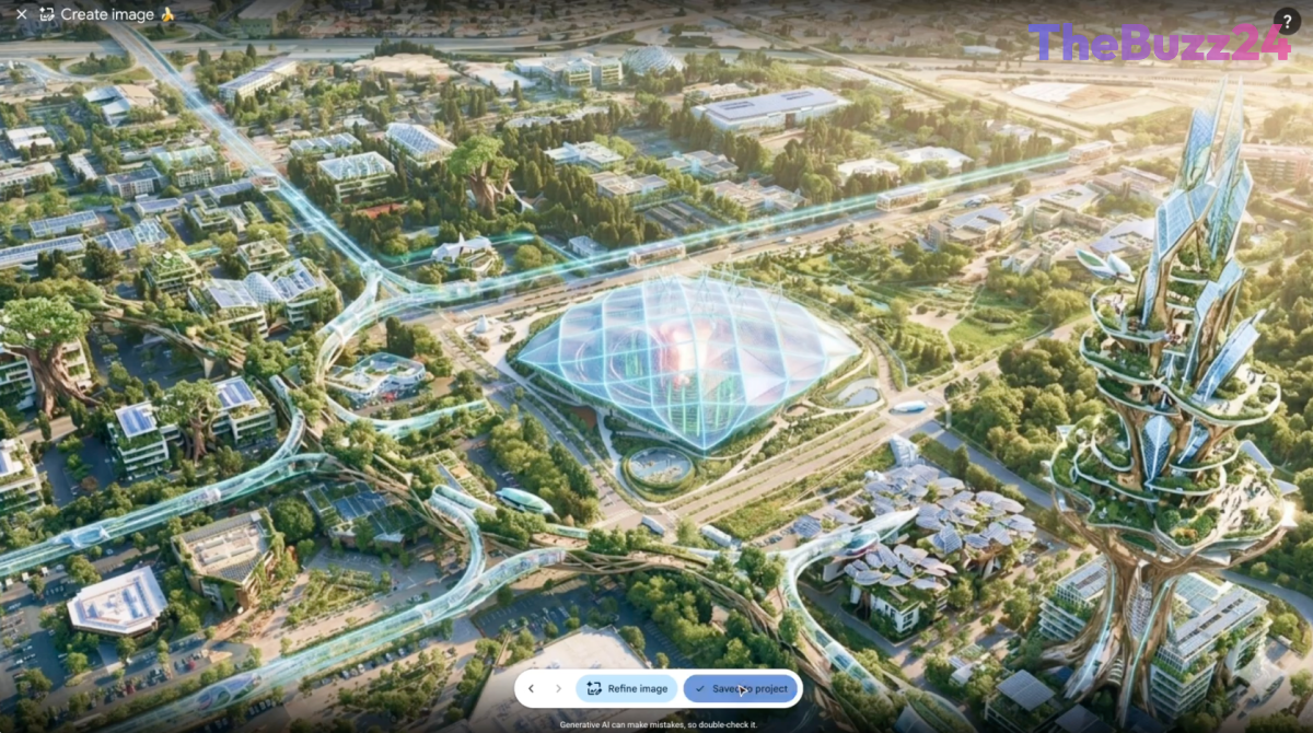
Google Pulls Plug on Google Earth AI Image Generator After Just One Day
Google has abruptly withdrawn a newly introduced feature on its Google Earth platform that allowed individuals to generate and superimpose fabricated imagery onto real satellite maps using its Nano Banana 2 artificial intelligence tool. Initially marketed as a creative outlet for exploring geography, the capability was quickly met with intense backlash from researchers, journalists, and digital safety experts who warned it could severely compromise the integrity of reliable visual data.
The prompt-based tool enabled users to seamlessly overlay AI-generated visuals onto authentic global mapping data. Critics immediately highlighted the potential for malicious actors to exploit the function to flood the internet with deceptive geospatial content and false propaganda, undermining Google Earth’s reputation as a trusted reference tool for investigators and academics.
Acknowledging the rapid escalation of policy-violating content being shared across social media, the tech giant issued a swift reversal just twenty-four hours after the feature’s public debut. While noting that some professionals had explored constructive applications for the tech, leadership conceded that the risks associated with unverified imagery necessitated an immediate halt.
Google stated that the feature has been completely rolled back while development teams focus on building more robust safety measures and guardrails. This incident highlights the broader industry-wide struggle tech companies face in balancing creative generative AI capabilities with the urgent need to prevent the widespread dissemination of digital disinformation.
Key Takeaways
- Google withdrew its new Google Earth AI image generation feature only 24 hours after launch.
- The tool allowed users to superimpose AI-created visuals onto real satellite maps, drawing heavy criticism from journalists and researchers.
- Google cited policy violations and the spread of inappropriate screenshots as the primary reasons for the rollback while promising stronger guardrails.
Editor’s Analysis & Impact
The rapid deployment and subsequent withdrawal of Google’s mapping AI feature underscore a critical friction point in the current technological landscape: the tension between rapid innovation and proactive safety protocols. As generative AI becomes increasingly accessible, platforms that anchor their credibility in objective reality—such as mapping services and archival databases—face unprecedented vulnerabilities to synthetic manipulation. This misstep serves as a cautionary tale for the tech sector, illustrating that retrofitting guardrails after a public release can severely damage user trust. Moving forward, companies must rigorously stress-test multimodal AI tools for societal impact before integration into essential public infrastructure utilities.
Frequently Asked Questions
Q: Why did Google remove the new Google Earth feature?
A: Google pulled the feature due to immediate and widespread criticism that the tool could be easily abused to create and spread geospatial misinformation.
Q: How long was the AI feature available to the public?
A: The feature was active for approximately 24 hours before Google decided to roll it back.
Q: Will the AI mapping feature return in the future?
A: Google indicated that the feature is currently rolled back while the company works on developing stronger guardrails and policies to prevent abuse.
AI Disclosure: This article is based on verified data and official reports. Our Team and AI have cross-referenced every financial detail with primary sources to ensure total accuracy.
More from this Category