Catastrophic Nepal-Tibet Floods Triggered by Massive Glacial Collapse, Scientists Reveal
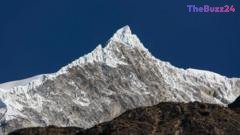
Recent scientific investigations have uncovered that a catastrophic glacial collapse was the primary catalyst behind the devastating flash floods that struck the Nepal-Tibet border region, resulting in a tragic loss of at least 177 lives. Initial assumptions pointed toward an earthquake-induced landslide, but geological data and expert analysis confirmed that the disaster originated from a massive disintegration of ice and rock near the Langtang Lirung peak.
The impact of the glacier hitting the valley floor generated a force equivalent to a 5.2 magnitude event. Researchers noted that an ice-rock avalanche plunged into the Lende Khola, a tributary of the Bhote Koshi river, causing a sudden and violent surge. Water levels in downstream rivers drastically rose by up to nine meters within a mere 30-minute window, washing away critical monitoring infrastructure and leaving communities defenseless against the wall of water and debris.
Experts attribute the unprecedented scale of the disaster to a dangerous convergence of tectonic activity and climate change. As the Himalayan mountain range continues to rise, glaciers grow increasingly steep and unstable. Coupled with rising global temperatures accelerating ice melt and thawing permafrost, high-mountain environments are becoming alarmingly vulnerable to large-scale collapses. Similar devastating events have been documented globally, signaling an urgent need for enhanced monitoring and climate adaptation strategies in fragile mountainous regions.
Key Takeaways
- A catastrophic glacial collapse near Nepal's Langtang Lirung peak was identified as the root cause of the deadly border floods.
- The impact of the falling ice and rock registered a 5.2 magnitude force, sending a massive wall of debris down local river tributaries.
- Scientists warn that the disaster highlights a dangerous combination of tectonic mountain uplifting and accelerated climate change.
Editor’s Analysis & Impact
The catastrophic flooding along the Nepal-Tibet border underscores the compounding vulnerabilities of high-altitude regions facing rapid climate change and tectonic shifts. As Himalayan glaciers continue to retreat and destabilize at unprecedented rates—losing ice at double the historical rate—communities downstream face exponential risks from glacial lake outbursts and sudden ice avalanches. Economically and socially, these recurring disasters devastate local infrastructure, agriculture, and tourism, demanding urgent international investment in early warning systems and climate-resilient engineering. The findings from geologists and intergovernmental organizations emphasize that high-mountain cryosphere hazards are no longer isolated incidents but part of a worsening global pattern driven by a warming planet, requiring proactive policy interventions and cross-border disaster management frameworks.
Frequently Asked Questions
Q: What caused the flash floods on the Nepal-Tibet border?
A: Scientists determined that the floods were triggered by a massive glacial collapse near the Langtang Lirung peak, which sent a destructive wave of ice, rock, and water down into local river tributaries.
Q: How did the disaster impact local river levels?
A: Water levels in rivers downstream surged by seven to nine meters within a span of just 30 minutes, overwhelming the area and destroying water monitoring stations.
Q: What role does climate change play in these glacial collapses?
A: Rising global temperatures cause glaciers to melt rapidly and thaw centuries-old permafrost that helps hold mountainsides together, ultimately destabilizing high-mountain environments and increasing the frequency of catastrophic collapses.
AI Disclosure: This article is based on verified data and official reports. Our Team and AI have cross-referenced every financial detail with primary sources to ensure total accuracy.
More from this Category