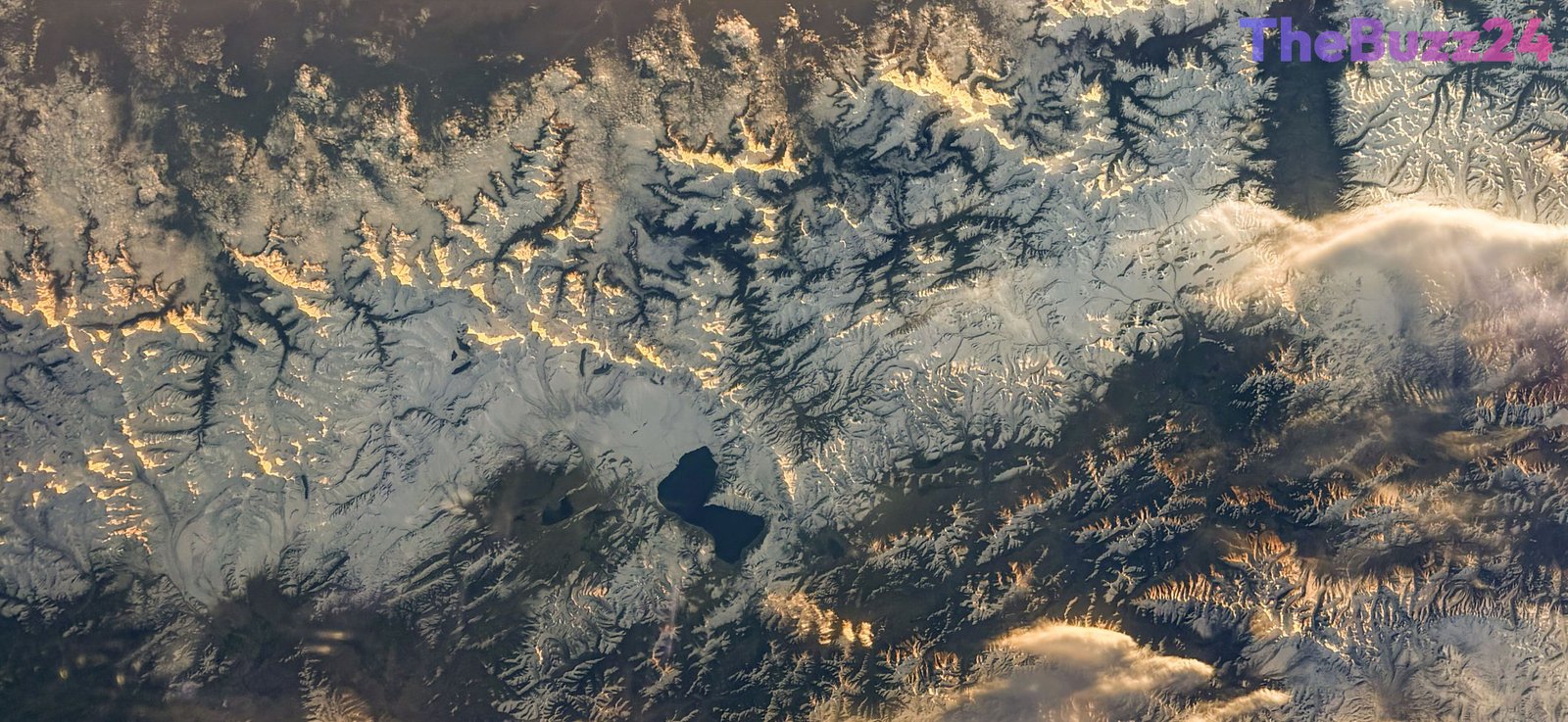
Astronaut Captures Stunning Aerial View of Lake Pelku from Orbit
A striking new photograph taken from the International Space Station offers a rare perspective of Lake Pelku, situated in the high-altitude regions of Asia. The image, captured by astronaut Joshua Kutryk, highlights the unique geological features of the lake as seen from low Earth orbit, providing a clear view of the surrounding landscape.
The International Space Station continues to function as a premier vantage point for monitoring Earth’s surface. Equipped with both sophisticated automated sensors and manual imaging technology, the station allows crew members to document environmental changes, weather patterns, and geographical landmarks in real time. These observations are vital for ongoing scientific research and global disaster management efforts.
Since the inception of the station, astronauts have compiled a vast archive of hundreds of thousands of images. This extensive collection serves as a critical resource for scientists and researchers studying the planet’s evolution. By capturing high-resolution imagery of remote locations like Lake Pelku, space agencies contribute to a deeper understanding of Earth’s diverse ecosystems and the impact of human and natural activity on the environment.
Key Takeaways
- Astronaut Joshua Kutryk captured a high-resolution image of Lake Pelku from the International Space Station.
- The International Space Station serves as a critical platform for real-time Earth observation and scientific research.
- Imagery captured by station crew members supports global disaster relief efforts and environmental monitoring.
Editor’s Analysis & Impact
The ability to capture high-fidelity imagery from the International Space Station represents a significant intersection of aerospace technology and environmental science. By providing a consistent, orbital perspective, these missions enable the longitudinal study of Earth’s geography, which is increasingly important in the context of climate change and resource management. As commercial space flight expands and more automated imaging platforms are deployed, the volume of data available to researchers will grow exponentially. This trend suggests a future where real-time monitoring of remote or inaccessible regions becomes standard, significantly enhancing our capacity for disaster response and ecological preservation. The integration of human-led photography with automated sensor data remains a powerful tool for global scientific collaboration.
Frequently Asked Questions
Q: Why is the International Space Station important for Earth observation?
A: The station provides a unique, constant vantage point that allows astronauts and automated systems to monitor environmental changes, weather, and geographical features across the globe in real time.
Q: How are images from the space station used?
A: These images are utilized for scientific research, disaster relief planning, and documenting long-term environmental changes on Earth.
AI Disclosure: This article is based on verified data and official reports. Our Team and AI have cross-referenced every financial detail with primary sources to ensure total accuracy.
More from this Category