Inside Arizona’s Volcanic Wonderland: The Evolution of America’s Newest National Park
Millions of years ago, a catastrophic volcanic eruption in what is now southeastern Arizona reshaped the landscape by discharging an immense volume of molten material. This ancient event released volcanic debris exceeding a thousand times the volume produced by the 1980 Mount St. Helens eruption, covering the traditional homelands of the Chiricahua Apache Nation in deep layers of ash, pumice, and searing pyroclastic flows that eventually cooled into thick deposits of welded rhyolitic tuff.
As the underground magma chamber emptied, the overlying surface collapsed, creating a massive depression known as the Turkey Creek caldera. Over subsequent epochs, continuous processes of weathering and erosion carved this hardened rock layer into a breathtaking array of geological formations, including soaring spires, balanced boulders, and intricate canyons. Recognizing its unique landscape, the Apache fittingly named the region “The Land of the Standing-Up Rocks.”
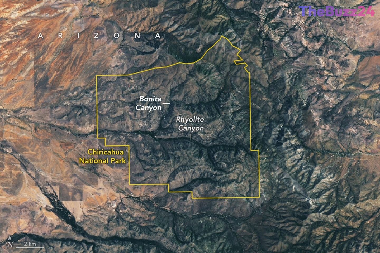
The area was initially protected as a national monument in 1924 before achieving official redesignation as a national park. Modern satellite imaging continues to capture the distinct topography of the region, highlighting the gray rhyolitic spires contrasting against tree-lined stream valleys like Rhyolite Canyon and Bonita Canyon.
Furthermore, the park serves as a vital ecological crossroads where four distinct biogeographic regions converge: the Sonoran Desert, the Chihuahuan Desert, the Rocky Mountains, and the Sierra Madre. This unique geographic intersection fosters remarkable biodiversity, supporting roughly one thousand plant species across diverse ecosystems that range from desert grasslands to coniferous mountain forests. Functioning as a prominent “sky island,” the terrain rises dramatically from the surrounding lowlands, creating an isolated ecological haven in the American Southwest.
Key Takeaways
- A massive volcanic eruption 27 million years ago laid the geological foundation for the region now designated as Chiricahua National Park.
- The collapse of a subsurface magma chamber formed the Turkey Creek caldera, which later eroded into iconic rock spires and hoodoos.
- The park acts as a critical ecological "sky island" where four distinct biogeographic regions converge, supporting rich biodiversity.
Editor’s Analysis & Impact
The designation of Chiricahua as a national park highlights a growing emphasis on preserving geological heritage and biodiversity hotspots in the American Southwest. Beyond its striking visual appeal, the park’s status as a “sky island” provides invaluable opportunities for ecological research, particularly regarding how localized climate shifts impact isolated mountainous ecosystems surrounded by desert environments. From an economic and tourism perspective, the elevation to national park status is expected to draw increased visitors to southeastern Arizona, prompting regional investments in conservation infrastructure, sustainable tourism management, and local hospitality sectors. Such designations consistently boost public awareness of lesser-known geological formations while balancing increased foot traffic with stringent environmental protections.
Frequently Asked Questions
Q: How were the rock formations in Chiricahua National Park created?
A: The formations were created by a massive volcanic eruption 27 million years ago that deposited thick layers of volcanic ash and tuff, which subsequently eroded over millennia into spires, hoodoos, and canyons.
Q: What makes Chiricahua an ecological "sky island"?
A: It is considered a sky island because it features isolated mountain ecosystems rich in flora and fauna that rise dramatically above the surrounding low-elevation desert terrain.
Q: When did the area officially become a national park?
A: After being protected as a national monument since 1924, the area was officially redesignated as a national park in October 2026.
AI Disclosure: This article is based on verified data and official reports. Our Team and AI have cross-referenced every financial detail with primary sources to ensure total accuracy.
More from this Category