NASA Evaluates Umbra Satellite Data: Strengths and Weaknesses Revealed for Earth Science Research
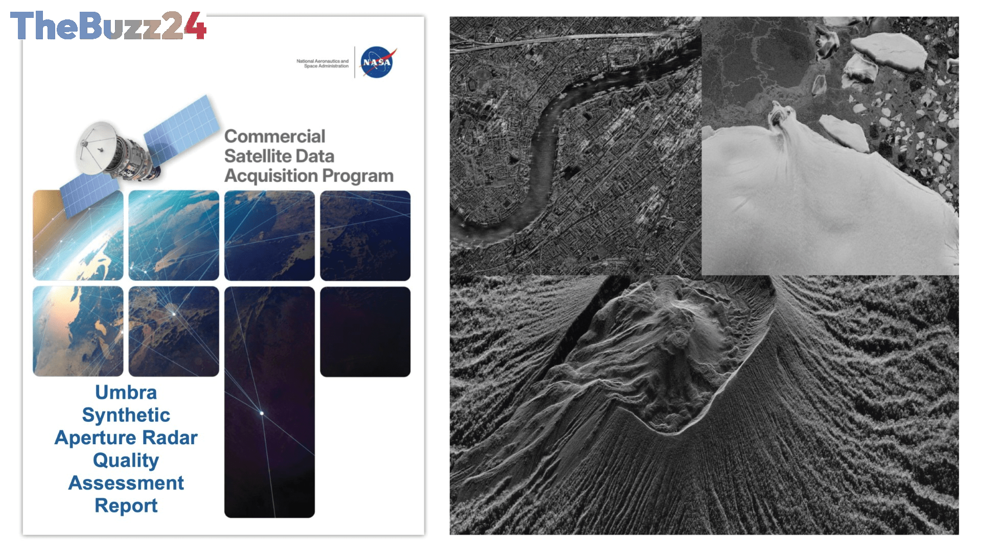
NASA’s Commercial Satellite Data Acquisition (CSDA) program has released comprehensive evaluations of data provided by Umbra’s synthetic aperture radar (SAR) satellite constellation. These reports, aimed at informing NASA’s Earth science community and program management, assess the quality and utility of Umbra’s X-band SAR data for scientific research and applications.
The evaluations, comprising a Principal Investigator Evaluation Summary and Quality Assessment Reports, highlight both the advantages and limitations of Umbra’s commercial data. Strengths identified include the constellation’s high spatial resolution, the ability to task satellites for rapid, high-temporal-repeat acquisitions crucial for monitoring dynamic environmental conditions like algal blooms, imaging flexibility across various angles, and the company’s Open Data Program. These features make Umbra data potentially valuable for time-sensitive research workflows.
However, the assessments also pointed out significant areas for improvement. The Principal Investigator teams reported issues with the accuracy of Umbra data geolocation, citing both large and small errors. Additionally, challenges were noted regarding software compatibility, metadata completeness, and the availability of technical documentation. These factors could impede the seamless integration and application of the data within existing research frameworks.
Further detailed analysis by NASA subject matter experts, following joint NASA/ESA guidelines, corroborated some of these findings. While the spatial resolution met Umbra’s specifications, the geometric accuracy, particularly geolocation, did not consistently align with the company’s claims, leading to the conclusion that the overall positioning performance fell short of expectations. Radiometric performance also underperformed compared to established, well-calibrated SAR systems in terms of absolute accuracy, stability, and sensitivity. The CSDA program’s objective is to identify and evaluate commercial data sources that can complement NASA’s existing Earth observation capabilities, potentially offering cost-effective solutions for advancing Earth System Science.
Key Takeaways
- NASA's CSDA program has evaluated Umbra's X-band SAR satellite data, identifying key strengths and weaknesses.
- Strengths include high spatial resolution and flexible tasking for time-sensitive environmental monitoring, while weaknesses involve geolocation accuracy and software compatibility.
- The evaluations suggest Umbra data has potential for Earth science research but requires further improvements in geometric accuracy and documentation to meet NASA's standards.
Editor’s Analysis & Impact
The NASA evaluations of Umbra’s SAR data underscore the growing role of commercial satellite imagery in Earth science. While Umbra offers compelling advantages like high resolution and rapid tasking, the identified issues with geolocation accuracy and radiometric performance present significant hurdles for widespread adoption in critical scientific applications. These findings highlight the ongoing challenge for commercial data providers to meet the rigorous standards required by space agencies. For NASA, this means a careful balancing act between leveraging cost-effective commercial data and ensuring the scientific integrity of its research. The industry will likely see continued efforts to refine data quality and processing to bridge this gap, potentially leading to more robust and reliable commercial Earth observation solutions in the future.
Frequently Asked Questions
Q: What is Synthetic Aperture Radar (SAR)?
A: Synthetic Aperture Radar (SAR) is a type of radar imaging that uses the motion of the sensor to simulate a much larger antenna, thereby achieving higher resolution than would otherwise be possible. SAR systems can image the Earth's surface regardless of weather conditions or time of day.
Q: What are the main concerns raised in the NASA evaluation of Umbra data?
A: The primary concerns raised in the NASA evaluation relate to the accuracy of Umbra's data geolocation, which did not consistently meet the company's specifications or NASA's expectations. Additionally, the radiometric performance was found to underperform compared to established SAR systems, and issues with software compatibility and metadata were noted.
Q: What is the purpose of NASA's Commercial Satellite Data Acquisition (CSDA) program?
A: The CSDA program aims to identify, evaluate, and acquire data from commercial satellite sources to support NASA's Earth science research and applications. It seeks to leverage commercial capabilities to advance Earth System Science and provide cost-effective data that can complement existing NASA and partner observations.
AI Disclosure: This article is based on verified data and official reports. Our Team and AI have cross-referenced every financial detail with primary sources to ensure total accuracy.
More from this Category