NASA Upgrades Satellite Data Explorer to Streamline Earth Observation Access
NASA is set to host a comprehensive virtual session on June 17, 2026, to unveil significant enhancements to its Satellite Data Explorer (SDX) platform. As the central hub for the Commercial Satellite Data Acquisition (CSDA) program, the SDX serves as a vital portal for authorized researchers and analysts to discover, access, and request high-resolution commercial Earth observation imagery. This update represents a major step in the agency’s ongoing mission to modernize how scientific communities engage with complex satellite datasets.
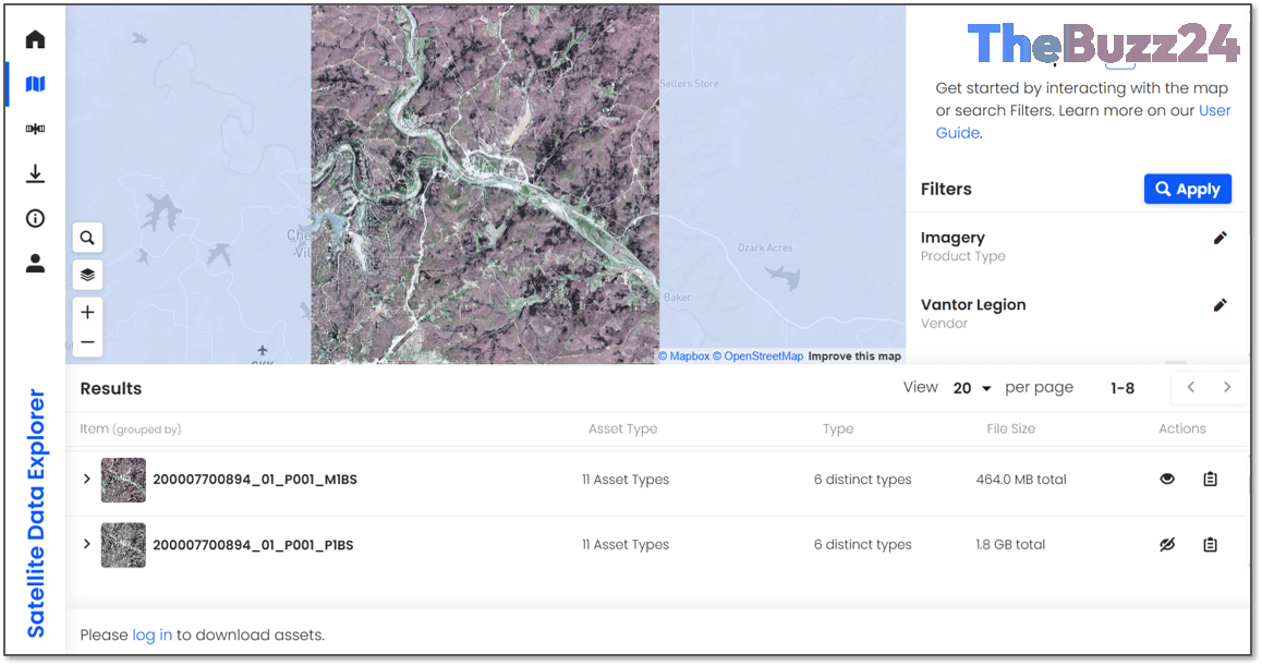
The upcoming webinar will provide a detailed walkthrough of the platform’s improved interface, which is designed to minimize the technical hurdles often encountered during data retrieval. Attendees will receive live demonstrations of advanced filtering tools that allow for granular data selection based on specific geographic regions, product types, and vendor-specific criteria. Additionally, the session will showcase new interactive mapping features and quick-look imagery tools, enabling users to rapidly visualize and evaluate data before committing to full downloads.
Perhaps the most notable addition is the debut of the Data Acquisition Request System. This new integration allows users to submit and track requests for future satellite imagery directly within the SDX environment. By centralizing the procurement lifecycle, NASA aims to create a more cohesive and efficient workflow for professionals who rely on commercial satellite data to support their research, environmental monitoring, and operational projects.
Key Takeaways
- NASA will host a webinar on June 17, 2026, to showcase the upgraded Satellite Data Explorer (SDX) platform.
- The platform now features advanced filtering and mapping tools to improve the speed and precision of satellite data discovery.
- A new integrated Data Acquisition Request System will allow users to manage and track future imagery requests within a single interface.
Editor’s Analysis & Impact
The integration of tasking capabilities directly into the Satellite Data Explorer marks a pivotal shift toward ‘data-as-a-service’ models within the public sector. By lowering the barrier to entry for commercial satellite imagery, NASA is effectively democratizing access to high-resolution Earth observation data, which has historically been difficult to procure. This move is expected to accelerate innovation across diverse fields, including climate science, disaster response, and urban planning. As commercial satellite constellations continue to expand in both number and capability, the ability to seamlessly task these assets through a centralized government portal will provide a significant competitive advantage for researchers. This development underscores a long-term trend of increasing reliance on private-sector partnerships to augment and modernize governmental scientific infrastructure.
Frequently Asked Questions
Q: Who is eligible to use the Satellite Data Explorer?
A: The SDX platform is restricted to authorized users associated with the Commercial Satellite Data Acquisition (CSDA) program, which primarily includes researchers and analysts working on approved projects.
Q: What is the primary purpose of the new Data Acquisition Request System?
A: The system is designed to centralize and simplify the entire lifecycle of satellite data procurement, allowing users to submit, manage, and track requests for future imagery within one unified environment.
AI Disclosure: This article is based on verified data and official reports. Our Team and AI have cross-referenced every financial detail with primary sources to ensure total accuracy.
More from this Category