Super El Niño Surges Past Historical Records Ahead of Expected Peak
The ongoing El Niño climate phenomenon has intensified to levels that experts are describing as unprecedented, shattering multiple historical temperature records weeks ahead of its projected December peak. Meteorological authorities tracking the equatorial Pacific have recorded average weekly sea-surface temperatures climbing to their highest points in modern observational history. These readings surpass previous benchmarks set during the famously strong El Niño event of 2015.
This year’s temperature spikes are occurring against a backdrop of long-term ocean warming driven by human-induced climate change. To account for this background warming and allow for accurate comparisons with historical events, meteorological agencies have begun utilizing specialized metrics like the Relative Ocean El Niño Index. Even when factoring out the baseline warming trend, current subsurface warmth and sea-surface anomalies outpace the record-breaking conditions observed in December 2015.
Furthermore, the extreme thermal energy is not confined to the traditional equatorial monitoring zones. Elevated temperatures have spilled far beyond standard boundaries, spreading deep into the Pacific and extending toward the Gulf of Mexico. Climatologists note that the sheer geographic scope of the warmth distinguishes this cycle from past major events, amplifying concerns about widespread meteorological disruptions.
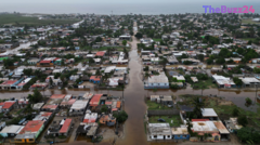
As the phenomenon continues to release substantial amounts of heat from the oceans into the atmosphere, international organizations are warning of cascading environmental impacts. Past super El Niños have historically triggered severe droughts in parts of southeast Asia and southern Africa, alongside devastating floods in East Africa and shifting tropical cyclone patterns. While regional effects vary considerably, early disruptions to agriculture, water resources, and food security are already being documented in vulnerable regions globally.
Key Takeaways
- Average weekly sea-surface temperatures in the central Pacific have reached historic highs, surpassing the previous benchmark set in 2015.
- Specialized indices that strip away human-induced background warming confirm that the current El Niño is unprecedented in modern records.
- The extreme thermal energy is spreading beyond traditional monitoring zones, increasing risks of global weather disruptions, droughts, and floods.
Editor’s Analysis & Impact
The intensification of the current super El Niño highlights a compounding vulnerability in global climate patterns, where natural climatic cycles collide with accelerated long-term anthropogenic warming. From an economic and industrial perspective, these unprecedented ocean temperatures pose immediate risks to global supply chains, agricultural yields, and energy grids. Food security in vulnerable regions such as East Africa and southeast Asia remains highly susceptible to the droughts and floods typically ushered in by these intense weather phases. Furthermore, commodity markets—particularly agriculture and insurance—must price in higher volatility as extreme weather events become more frequent and severe. Looking forward, the persistence of elevated global temperatures through the upcoming years will force governments and multinational corporations to accelerate climate adaptation strategies, upgrade infrastructure resilience, and heavily invest in predictive meteorological modeling.
Frequently Asked Questions
Q: What is an El Niño event?
A: El Niño is a naturally occurring climate pattern characterized by the warming of sea-surface temperatures in the central and eastern tropical Pacific Ocean, which happens every two to seven years and typically lasts about a year.
Q: How does human-induced climate change affect El Niño?
A: While climate change does not necessarily make El Niño events happen more frequently, the overall background warming of the oceans combines with El Niño's natural heat release, amplifying global temperature records and masking the distinct boundaries of natural cycles.
Q: When is the current El Niño expected to peak?
A: Meteorological forecasts from major international agencies indicate that the current El Niño is expected to reach its peak intensity in December, with its widespread weather impacts likely extending well into the following year.
AI Disclosure: This article is based on verified data and official reports. Our Team and AI have cross-referenced every financial detail with primary sources to ensure total accuracy.
More from this Category