The Lunar Standard: How NASA Uses the Moon to Calibrate Earth-Observing Satellites
Maintaining the integrity of Earth observation data over several decades requires more than just high-end hardware; it demands a sophisticated and consistent calibration strategy. To bridge the gap between modern satellite imagery and data collected as far back as the 1970s, scientists have turned to the Moon as a reliable, unchanging reference point. Because the lunar surface lacks an atmosphere and remains geologically static, it provides an ideal benchmark for testing the precision of sensitive instruments aboard satellites such as Landsat 9.
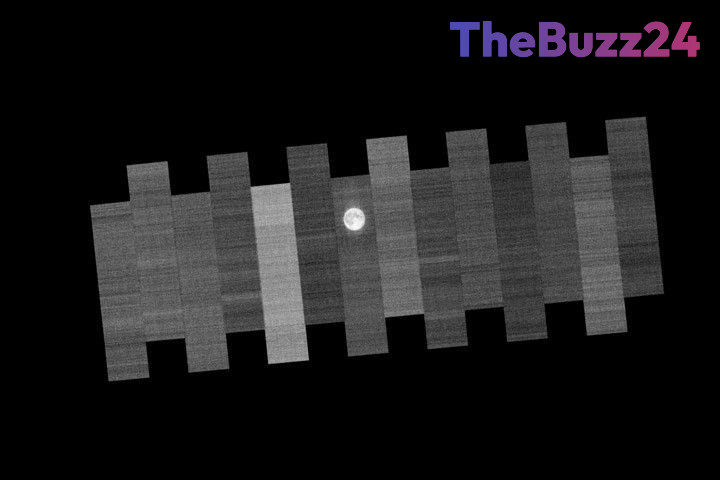
Each month, when the Moon reaches its full phase, the Landsat spacecraft performs a specialized maneuver. The satellite rotates its sensors away from the Earth to conduct a detailed scan of the lunar surface. By analyzing how the Moon reflects sunlight, engineers can detect and correct any ‘drift’ in the satellite’s sensor readings. This rigorous process is vital for ensuring that data remains consistent, allowing researchers to track long-term environmental changes—such as agricultural shifts or glacial melting—with high scientific confidence.
In addition to lunar observations, the calibration process relies on terrestrial validation methods. Engineers utilize uniform locations, such as the White Sands desert in New Mexico, to cross-reference thermal and visual data. These combined efforts distinguish professional satellite imagery from standard photography, transforming raw light measurements into precise, actionable tools for monitoring the planet’s evolving landscape.
Key Takeaways
- The Moon acts as a stable, atmospheric-free benchmark for calibrating satellite sensors to ensure data consistency over decades.
- Landsat 9 conducts monthly lunar scans to identify and rectify sensor drift, which is critical for accurate environmental monitoring.
- Calibration protocols combine lunar observations with terrestrial validation sites like the White Sands desert to maintain high-quality scientific data.
Editor’s Analysis & Impact
The use of the Moon as a calibration tool underscores the critical intersection between celestial mechanics and climate science. As the global demand for high-resolution environmental data intensifies, the ability to compare contemporary observations with historical records is essential for accurate climate modeling and informed policy decisions. By standardizing sensor performance, space agencies mitigate the risk of data degradation, ensuring that long-term trends in deforestation, urban expansion, and climate change are not obscured by technical inconsistencies. This methodology reflects a broader industry shift toward self-correcting, autonomous systems. As the aerospace sector moves toward larger satellite constellations, the implementation of automated, standardized calibration protocols will be fundamental to maintaining the integrity of global Earth observation networks and the scientific insights they provide.
Frequently Asked Questions
Q: Why is the Moon used for satellite calibration instead of Earth?
A: The Moon is used because it lacks an atmosphere and remains geologically unchanged, providing a consistent, stable light-reflectance benchmark that Earth cannot offer due to its dynamic weather and shifting landscape.
Q: How often do satellites like Landsat 9 perform these lunar scans?
A: Landsat 9 performs these specialized calibration maneuvers once every month, typically during the full Moon, to ensure its sensors remain accurately calibrated.
AI Disclosure: This article is based on verified data and official reports. Our Team and AI have cross-referenced every financial detail with primary sources to ensure total accuracy.
More from this Category