NASA’s PACE Satellite Emerges as a Critical Tool for Wildfire Monitoring
As North America faces increasingly intense fire seasons, NASA’s Plankton, Aerosol, Cloud, and ocean Ecosystem (PACE) satellite is providing unprecedented insights into wildfire dynamics. Although originally engineered to monitor oceanic and atmospheric health, the satellite’s advanced hyperspectral instrumentation has proven highly effective at tracking vegetation stress, identifying high-risk fire zones, and mapping the aftermath of blazes across the continent.
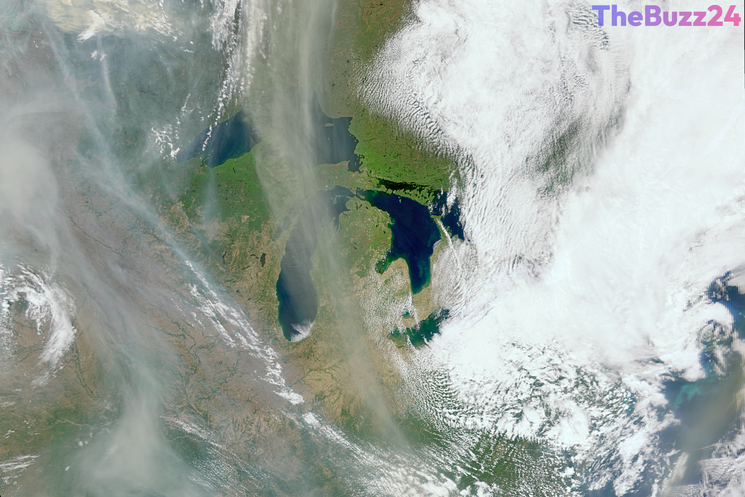
The satellite’s Ocean Color Instrument captures data across hundreds of wavelengths, including ultraviolet and near-infrared light. This capability allows researchers to assess plant health by measuring pigment balance and moisture levels, effectively flagging areas prone to ignition. By providing daily global coverage, the mission enables land managers to allocate resources more efficiently and monitor the evolution of burn scars, which are often susceptible to secondary disasters like landslides and flooding.
Beyond monitoring the land, PACE plays a vital role in tracking smoke plumes. By analyzing the chemical composition, size, and shape of aerosol particles, the satellite’s polarimeter instruments can distinguish wildfire smoke from other atmospheric pollutants. This data is crucial for understanding how smoke travels through the atmosphere and how it impacts air quality in distant regions. Scientists are now integrating these findings into predictive models to better simulate future fire scenarios and their broader environmental consequences.
Ultimately, the mission is transforming how experts approach wildfire mitigation. By providing a clearer picture of both the precursors to fires and the behavior of smoke in the atmosphere, the PACE mission is helping to refine Earth system models. This enhanced data set is expected to play a significant role in how global communities prepare for and respond to the growing threat of wildfires in a changing climate.
Key Takeaways
- NASA's PACE satellite, while designed for ocean and atmosphere study, is now a key asset in monitoring wildfire risks and burn scars.
- The satellite's hyperspectral sensors can detect plant stress and dryness, helping land managers identify areas at high risk for wildfires.
- PACE provides detailed data on smoke composition and altitude, which is essential for improving atmospheric models and predicting the impact of wildfire emissions.
Editor’s Analysis & Impact
The integration of the PACE satellite into wildfire monitoring represents a significant shift toward multi-purpose Earth observation. By repurposing ocean-focused technology for terrestrial and atmospheric fire tracking, NASA is demonstrating the value of hyperspectral imaging in climate resilience. The ability to distinguish between smoke particulates and other aerosols is a technical milestone that will likely lead to more accurate air quality forecasting and improved public health responses. As wildfire seasons become more volatile, the industry will likely see an increased reliance on such high-resolution, daily-coverage satellite data to inform policy and land management. The broader implication is a move toward a more integrated ‘Earth System’ approach, where data from one domain—such as ocean health—is leveraged to solve critical challenges in another, such as terrestrial fire management.
Frequently Asked Questions
Q: How does the PACE satellite identify areas at high risk for wildfires?
A: The satellite uses hyperspectral instruments to measure plant health, including pigment balance, stress levels, and dryness, which are key indicators of fire susceptibility.
Q: Can the PACE satellite distinguish between wildfire smoke and other types of pollution?
A: Yes. By measuring the light reflected off atmospheric particles, the satellite's polarimeter instruments can determine the size, shape, and chemical properties of aerosols, allowing scientists to identify smoke specifically.
AI Disclosure: This article is based on verified data and official reports. Our Team and AI have cross-referenced every financial detail with primary sources to ensure total accuracy.
More from this Category