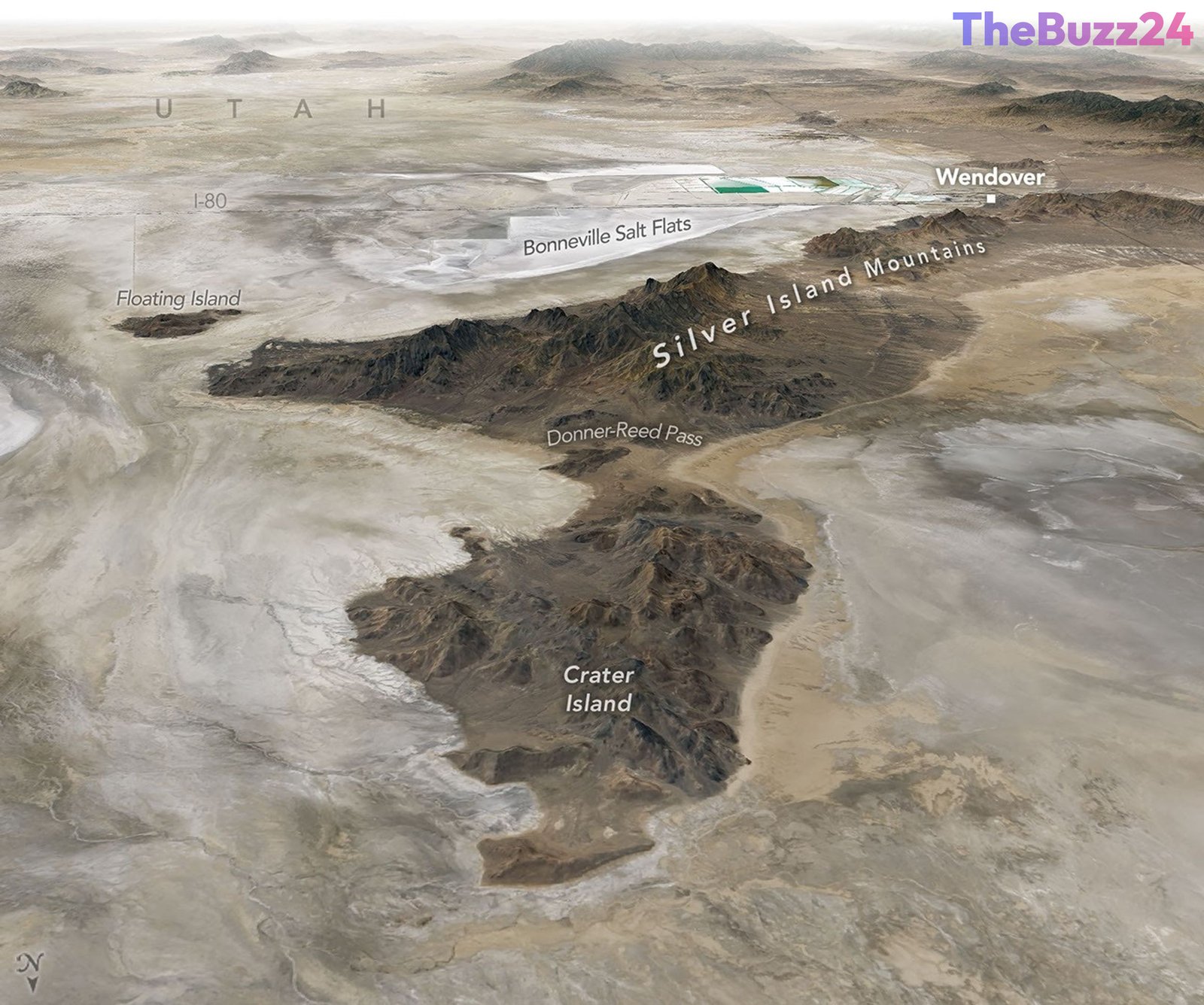
The Ancient Legacy of Lake Bonneville: From Ice Age Giant to Modern Testing Ground
The vast, arid landscape of western Utah serves as a stark reminder of a prehistoric era when Lake Bonneville dominated the region. At its peak, this massive Ice Age body of water rivaled Lake Michigan in size, stretching across parts of Utah, Nevada, and Idaho. Formed roughly 55,000 years ago due to volcanic activity that diverted the Bear River, the lake remained confined by a natural dam at Red Rock Pass for millennia. However, about 18,000 years ago, a catastrophic breach triggered one of North America’s largest floods, causing water levels to drop by over 350 feet in just six weeks. As the climate shifted, the lake receded, leaving behind the Great Salt Lake and the expansive, mineral-rich salt flats seen today.
Today, these salt flats are far more than a geological curiosity; they are a hub for human innovation and historical study. The unique, flat terrain has become a premier destination for land speed record attempts, including historic runs by Mickey Thompson and, more recently, Andy Green, who set a record in a hydrogen-fueled vehicle. The region’s history is also marked by the struggles of early pioneers, such as the Donner-Reed Party, whose wagons became mired in the treacherous mud of the basin in 1846, serving as a grim precursor to their later hardships.
Beyond its historical and recreational significance, the area has recently gained attention as a critical testing site for space exploration. Scientists have dubbed parts of the region “Venus on Earth” due to its geological characteristics. In June 2026, researchers utilized the terrain of Crater Island to field-test advanced camera systems and instrumentation designed for the upcoming DAVINCI mission to Venus. By conducting helicopter-based descent tests, the team successfully created three-dimensional maps of the landscape, proving that their technology is capable of capturing high-resolution data from the harsh, mountainous environments they expect to encounter on the planet Venus.
Key Takeaways
- Lake Bonneville was a massive Ice Age lake that receded 18,000 years ago, leaving behind the Great Salt Lake and vast mineral-rich salt flats.
- The region's unique, flat topography has made it a world-renowned site for land speed records, including recent advancements in hydrogen-fueled vehicle technology.
- NASA researchers are using the Utah landscape as a terrestrial analog to test instrumentation for the DAVINCI mission, which aims to explore the atmosphere and surface of Venus.
Editor’s Analysis & Impact
The utilization of terrestrial analogs like the Bonneville Salt Flats represents a critical shift in how space agencies validate mission hardware. By selecting environments that mimic the geological and atmospheric challenges of extraterrestrial bodies, researchers can significantly reduce mission risk. The ‘Venus on Earth’ testing program highlights the intersection of geology, engineering, and planetary science. Furthermore, the region’s dual identity—as both a site for industrial mineral extraction and a venue for high-speed automotive innovation—demonstrates the multifaceted utility of these ancient lakebeds. As we look toward the future of deep-space exploration, the ability to map and navigate alien terrains with high precision will be the defining factor in mission success. This research not only advances our understanding of Venus but also underscores the importance of preserving these unique geological sites for ongoing scientific inquiry.
Frequently Asked Questions
Q: Why is the area around Crater Island called 'Venus on Earth'?
A: It is referred to as 'Venus on Earth' because its geological formations and terrain provide an ideal testing ground for instruments designed to survive and photograph the extreme, mountainous environment of the planet Venus.
Q: What caused the dramatic shrinking of Lake Bonneville?
A: The lake shrank primarily due to a massive breach of a natural dam at Red Rock Pass 18,000 years ago, followed by a long-term shift toward a warmer, drier climate that caused the remaining water to evaporate.
AI Disclosure: This article is based on verified data and official reports. Our Team and AI have cross-referenced every financial detail with primary sources to ensure total accuracy.
More from this Category