Satellite Imagery Reveals Catastrophic Scale of Nepal Glacier Flood Devastation
Recent satellite data has provided a sobering look at the immense destruction left in the wake of a deadly flash flood along Nepal’s Trishuli River. Triggered by a massive glacier collapse, the wall of water and debris swept through mountain valleys, obliterating entire settlements, critical infrastructure, and hydroelectric facilities. Officials report that the disaster has claimed hundreds of lives, with many more individuals still unaccounted for as rescue teams struggle to reach isolated areas.
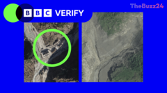
Visuals captured from orbit highlight the complete obliteration of a key border crossing between Nepal and Tibet. Buildings, roads, and bridges in the immediate vicinity were washed away by the sudden deluge, leaving behind thick layers of mud stretching kilometers upstream and high above the original riverbanks. Settlements such as Timure and Syapru Besi suffered catastrophic damage, with houses buried under rock and debris and local hydroelectric infrastructure severely compromised.
Further downstream, the village of Trishuli bore the brunt of the raging torrent. Comparative imagery and ground-level footage documented the collapse of local bridges and the complete erasure of entire residential neighborhoods. Amid the destruction, experts are closely monitoring the formation of a barrier lake near the site of the original landslide. Authorities have warned that the newly formed body of water poses a secondary flood risk, complicating ongoing search and recovery missions in the rugged terrain.
While international relief agencies utilize open-source spatial data to coordinate humanitarian efforts, the full extent of the disaster on the heavily restricted Tibetan side of the border remains difficult to ascertain. Glaciologists and emergency responders continue to evaluate the stability of the barrier lake, hoping to prevent any further catastrophe as communities begin the long and difficult process of recovery.
Key Takeaways
- A glacier collapse triggered a catastrophic flash flood along Nepal's Trishuli River, resulting in hundreds of fatalities and widespread missing persons.
- Satellite imagery shows entire villages, bridges, and hydroelectric stations entirely washed away or buried under thick mud and debris.
- A barrier lake formed at the landslide's base is currently being monitored by experts to assess the risk of secondary flooding.
Editor’s Analysis & Impact
The catastrophic flooding in Nepal underscores the escalating vulnerability of Himalayan communities to climate-induced cryosphere hazards, particularly glacier retreats and sudden glacial lake outburst floods (GLOFs). As global temperatures continue to rise, the structural integrity of high-altitude glaciers is increasingly compromised, posing severe existential threats to downstream populations and critical infrastructure across South Asia. This disaster highlights an urgent need for advanced, real-time early warning systems and robust cross-border hydrological monitoring between nations like Nepal and China. Furthermore, the economic impact on Nepal’s renewable energy sector—evidenced by the destruction of hydroelectric power stations—will likely strain the country’s energy grid and divert vital resources toward long-term reconstruction and climate resilience initiatives rather than growth.
Frequently Asked Questions
Q: What caused the flash flood in Nepal?
A: The flash flood was triggered by a massive glacier collapse that sent a torrent of water, rock, and debris surging down the Trishuli River valley.
Q: How are satellite images being used in the aftermath?
A: Satellite imagery is being utilized to assess the scale of destruction, locate missing infrastructure, and help rescue authorities determine where to focus relief efforts.
Q: Is there a risk of further flooding?
A: Yes, authorities have warned that a barrier lake formed at the base of the landslide poses a major risk of potential further flooding, though experts are closely monitoring its stability and drainage channels.
AI Disclosure: This article is based on verified data and official reports. Our Team and AI have cross-referenced every financial detail with primary sources to ensure total accuracy.
More from this Category