NASA Launches September 2026 Satellite Image Challenge to Test Earth Geography Enthusiasts
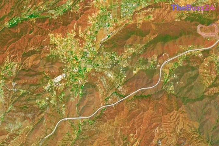
NASA has officially released its highly anticipated satellite image challenge for September 2026, inviting geography enthusiasts, scientists, and space observers worldwide to identify a mysterious location captured from orbit. The monthly initiative, curated by the agency’s Earth Observatory, aims to foster public engagement with Earth science by turning complex remote sensing data into an interactive global puzzle.
This month’s challenge presents a striking, high-resolution view of an undisclosed geographical feature, prompting participants to analyze visual clues such as geological formations, water bodies, and vegetation patterns. To successfully solve the puzzle, respondents are encouraged to go beyond simple location guessing. Advanced participants often attempt to identify the specific satellite and imaging instrument used, the spectral bands employed to capture the data, and the unique historical or geological context of the region.
While the challenge does not offer monetary rewards, successful participants compete for intellectual recognition and bragging rights within the global Earth science community. NASA plans to reveal the correct location and detailed scientific context in approximately one week. The reveal will be accompanied by an in-depth feature article detailing the environmental and geographical significance of the captured area, highlighting the first individual to correctly identify the site along with the most insightful community submissions.
Key Takeaways
- NASA's Earth Observatory has launched its interactive satellite image puzzle for September 2026 to promote public interest in Earth science.
- Participants are challenged to identify a mystery location using visual clues, with options to determine the satellite, instrument, and spectral bands used.
- The correct location and a detailed scientific analysis of the region will be revealed in one week, recognizing the first correct guessers.
Editor’s Analysis & Impact
NASA’s monthly satellite puzzles represent a highly effective strategy for public science communication, transforming complex remote sensing data into accessible, gamified education. By encouraging the public to analyze spectral bands, geological features, and satellite instrumentation, the initiative bridges the gap between professional Earth observation and citizen science. This level of engagement is increasingly important as climate change and environmental shifts make understanding Earth’s geography vital. Furthermore, such initiatives highlight the growing accessibility of high-resolution satellite data, which was once the exclusive domain of military and academic institutions. As commercial and public satellite constellations expand, fostering a public capable of interpreting this data will support broader environmental monitoring and conservation efforts globally.
Frequently Asked Questions
Q: What is the primary goal of the NASA Earth Observatory satellite puzzle?
A: The puzzle aims to engage the public with Earth science, encouraging people to learn how to interpret satellite imagery, understand geological features, and appreciate the technology used to monitor our planet from space.
Q: How can participants submit their answers to the challenge?
A: Participants can submit their guesses and detailed analyses through the official submission form provided on the Earth Observatory platform.
Q: What details can participants include to make their submissions stand out?
A: Beyond naming the location, participants can identify the specific satellite and sensor used, the spectral bands displayed, and any interesting geological, historical, or personal connections to the area.
AI Disclosure: This article is based on verified data and official reports. Our Team and AI have cross-referenced every financial detail with primary sources to ensure total accuracy.
More from this Category