NASA Challenges Public to Identify Mysterious July 2026 Satellite Image
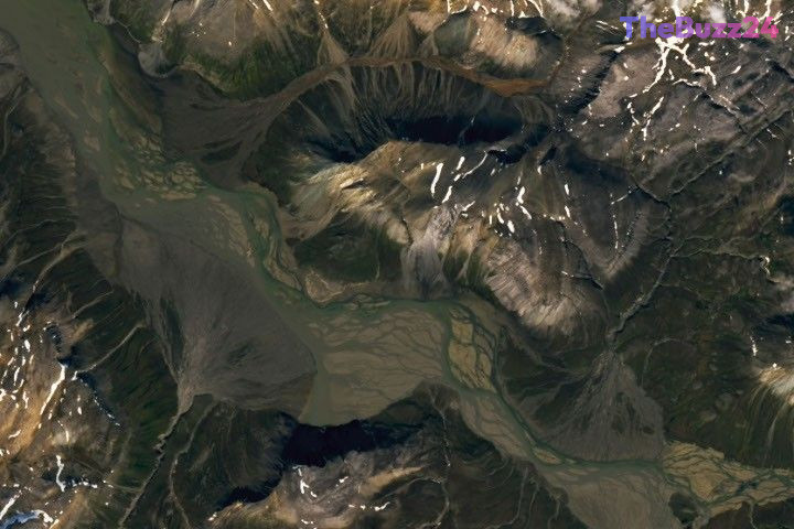
NASA has released its latest satellite imagery challenge for July 2026, inviting the public to test their geographical knowledge and remote sensing skills. The agency’s Earth Observatory platform has published a high-resolution image of an undisclosed location, tasking enthusiasts with identifying the site based solely on visual evidence captured from orbit.
Participants are encouraged to analyze the geological features, land use patterns, and environmental markers visible in the photograph. While a simple identification of the location is sufficient for entry, the agency is particularly interested in submissions that provide technical context, such as the specific satellite or instrument used to capture the data, or insights into the historical and geological significance of the depicted region.
Submissions are being accepted through an official online portal, where users can provide their guesses and personal observations. Following a one-week window, the agency plans to reveal the correct location and provide a detailed breakdown of the image’s origin. The initiative serves as an educational tool to promote interest in Earth science and remote sensing technology, offering contributors the chance to be recognized for their analytical efforts.
Key Takeaways
- NASA has launched a public satellite imagery identification challenge for July 2026.
- Participants are encouraged to provide technical details about the image, such as spectral bands or satellite instrumentation, to enhance their submissions.
- The agency will reveal the location and provide a comprehensive scientific explanation of the image one week after the challenge begins.
Editor’s Analysis & Impact
This initiative by NASA highlights the growing intersection between public engagement and scientific data literacy. By gamifying the interpretation of satellite imagery, the agency effectively democratizes access to complex remote sensing data, encouraging a broader audience to engage with Earth observation technology. From a market perspective, the increasing availability of high-resolution satellite data is fostering a new generation of ‘citizen scientists’ capable of identifying environmental changes, urban development, and geological shifts. As commercial satellite constellations continue to expand, the ability to interpret these images will become an increasingly valuable skill set. This type of public outreach not only builds brand affinity for space agencies but also underscores the critical role that satellite monitoring plays in understanding our changing planet, setting a precedent for how scientific institutions can leverage digital platforms to foster global curiosity.
Frequently Asked Questions
Q: How can I participate in the July 2026 satellite puzzler?
A: You can participate by visiting the official Earth Observatory website, viewing the image, and submitting your guess through the designated online form.
Q: Is there a monetary prize for correctly identifying the location?
A: No, there is no monetary prize. Participants receive 'bragging rights' and the possibility of having their analysis highlighted by the agency upon the reveal of the correct location.
AI Disclosure: This article is based on verified data and official reports. Our Team and AI have cross-referenced every financial detail with primary sources to ensure total accuracy.
More from this Category