Texas Cotton Farmers Face Existential Crisis as Historic Drought Drains Aquifers
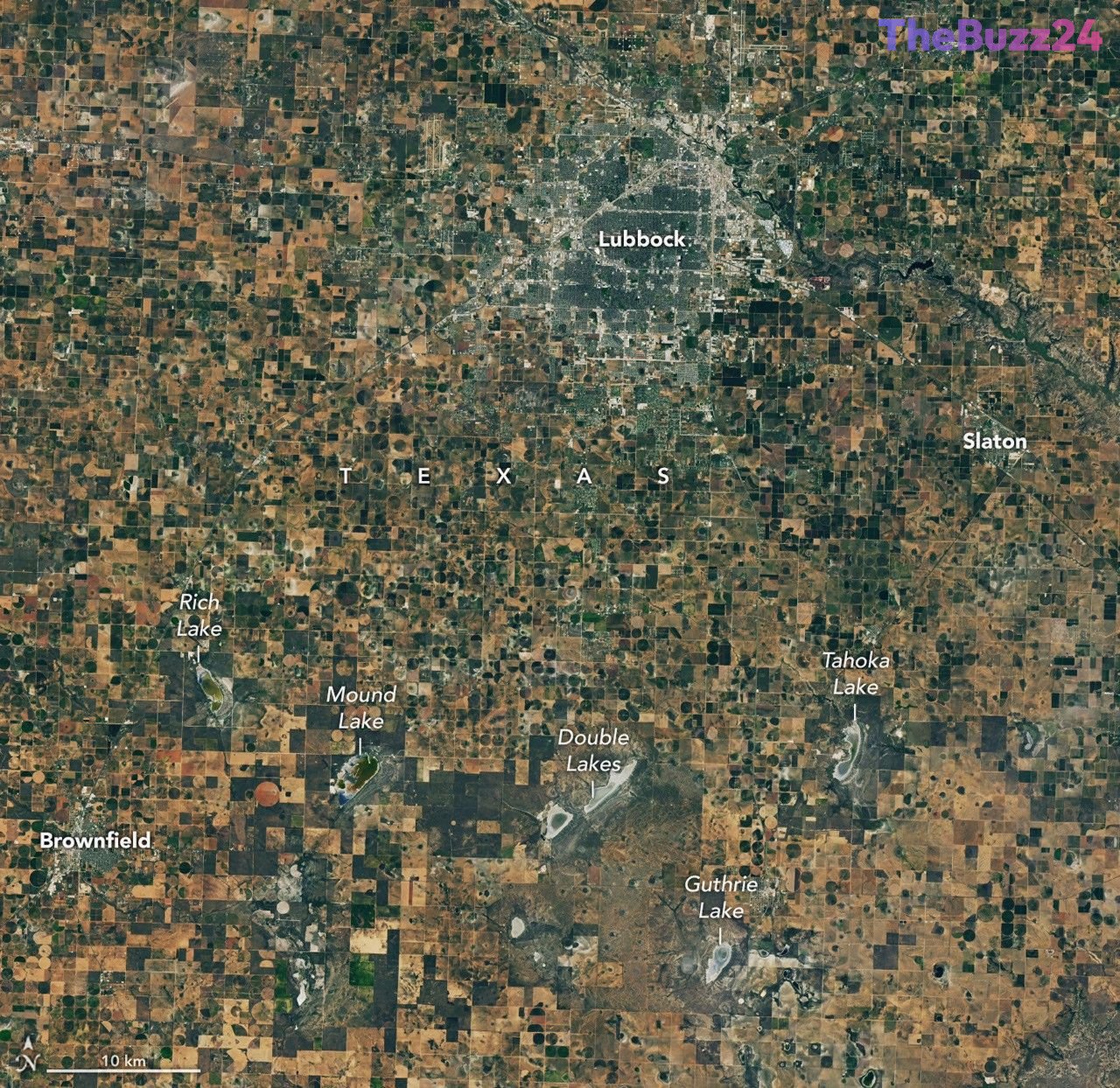
The Texas High Plains, a cornerstone of American cotton production, is currently grappling with a severe and unprecedented drought that has left local farmers facing catastrophic crop failures. Satellite imagery from September 2026 reveals a stark transformation of the landscape compared to the previous year, with once-productive fields now parched and brown. For many multi-generational farming families, the current conditions are not merely a cyclical challenge but an existential threat, as some report the total loss of dryland cotton crops for the first time in their history.
The crisis is exacerbated by the rapid depletion of the High Plains aquifer, the region’s primary source of irrigation. As groundwater levels continue to drop—with some areas seeing declines of over 100 feet since the mid-20th century—many farmers are finding their wells running dry. The situation has forced a shift in agricultural practices, with many producers forced to abandon irrigation on large portions of their land. Even the region’s ephemeral ‘playa lakes,’ which are vital for recharging the aquifer, have largely dried up, further destabilizing the local water cycle.
In response to these dire conditions, agricultural conservationists and research groups are increasingly turning to advanced technology to mitigate the damage. Partnerships between local farmers and scientific organizations are focusing on integrating satellite data to optimize planting schedules, manage cover crops, and restore the functionality of playa lakes. While recent rainfall has provided minor relief, experts warn that the region requires significant, sustained precipitation to break the cycle of drought. For the farming community, the focus has shifted toward long-term adaptation, including the exploration of alternative energy projects and water-efficient land management strategies to survive in an increasingly arid climate.
Key Takeaways
- Texas cotton farmers are experiencing record-breaking crop failures due to an intense, multi-year drought.
- The High Plains aquifer is depleting at an alarming rate, leaving many irrigation wells unable to draw water.
- Farmers and researchers are collaborating to use satellite data and conservation techniques to manage water scarcity and restore vital playa lakes.
Editor’s Analysis & Impact
The crisis in the Texas High Plains serves as a bellwether for the broader agricultural sector in the United States. As climate volatility increases, the reliance on finite groundwater resources like the High Plains aquifer is becoming unsustainable. The shift from traditional farming to water-credit programs and alternative land use suggests a fundamental restructuring of the regional economy. Moving forward, the industry will likely see an accelerated adoption of precision agriculture and AI-driven resource management as a necessity rather than a luxury. The long-term viability of this region as a global cotton hub depends heavily on the successful integration of conservation technology and a transition toward crops or practices that require significantly less water, as the era of abundant, easily accessible groundwater appears to be coming to a definitive end.
Frequently Asked Questions
Q: Why are playa lakes important to Texas farmers?
A: Playa lakes are shallow, clay-lined basins that collect rainfall and provide a critical pathway for water to seep underground, effectively recharging the High Plains aquifer.
Q: How are farmers using satellite data to combat the drought?
A: Farmers are partnering with research organizations to use satellite imagery and data to make informed decisions about when to plant, how to manage irrigation, and how to identify areas where soil and water conservation efforts will be most effective.
AI Disclosure: This article is based on verified data and official reports. Our Team and AI have cross-referenced every financial detail with primary sources to ensure total accuracy.
More from this Category