NASA’s Curiosity Rover Marks 14 Years on Mars with Scientific Exploration
NASA’s Mars rover Curiosity has recently celebrated its 14th landing anniversary on the Red Planet, marking over a decade of continuous scientific exploration. The milestone was observed by the mission team on Earth as the rover continued its ascent of Mount Sharp, meticulously investigating the planet’s geological history.
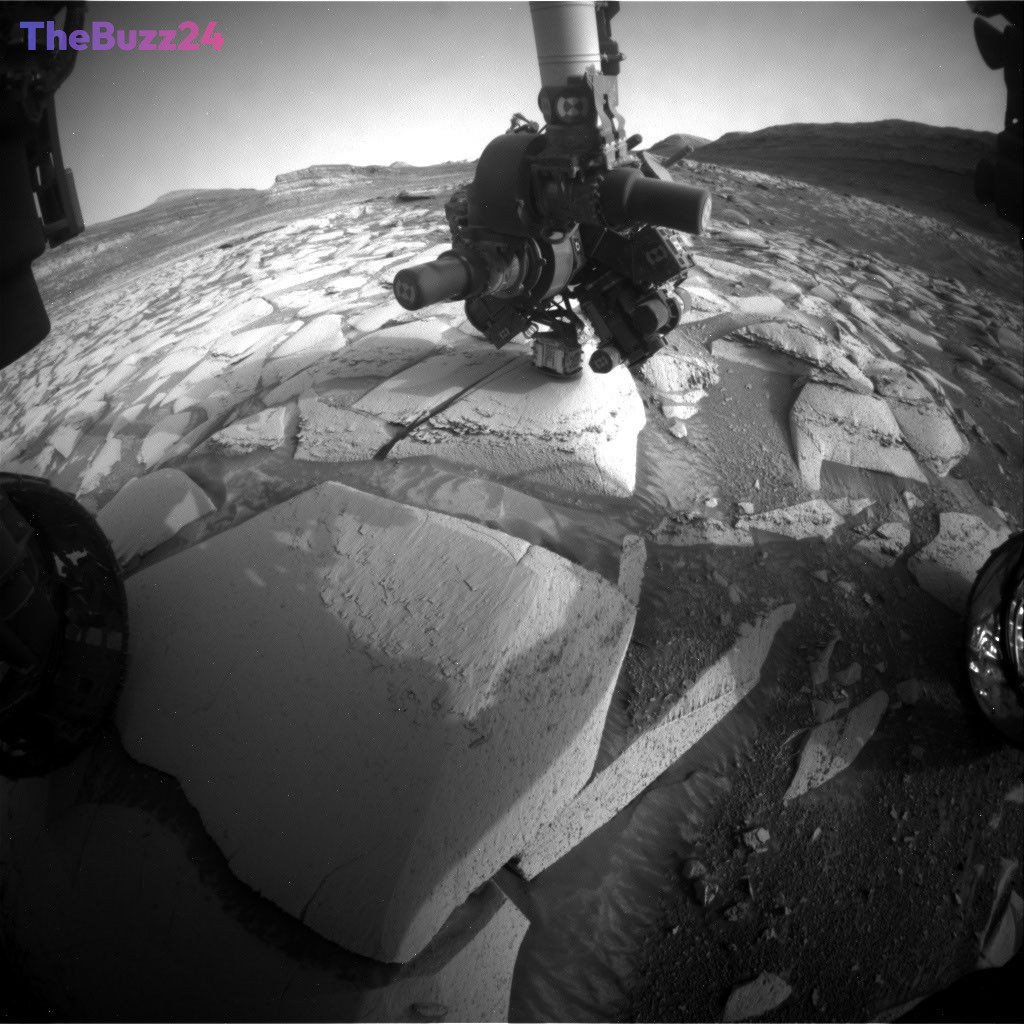
During the week of its anniversary, which transitioned from the rover’s 14th to its 15th year on Mars, Curiosity was actively engaged in its scientific duties. On Sol 4976, the rover’s robotic arm was deployed to conduct an Alpha Particle X-ray Spectrometer (APXS) measurement on a target named “Tunas Khasa.” This period also saw the rover navigating challenging terrain, with tilts reaching up to 24 degrees, demonstrating the engineering prowess that ensures its safe operation on the Martian surface.
The rover’s scientific instruments were hard at work analyzing various rock formations. The APXS and Mars Hand Lens Imager (MAHLI) examined targets like “Tunas Khasa” and “Villarrica.” The ChemCam instrument investigated “Lago Rupanco” and “Chulipa Punta,” utilizing its Remote Micro Imager to capture high-resolution images of geological features. Scientists are particularly focused on identifying cross-bedding, a geological indicator of ancient wind and water activity, to understand the planet’s past environments. Mastcam provided extensive imaging of rock layers, bedrock targets, and distant buttes, offering insights into the stratigraphy and erosional patterns.
Curiosity’s recent activities have positioned it at a location where two distinct rock layers converge, offering a unique opportunity to study the planet’s history. The rover will remain at this site for an extended period to conduct further analyses. The scientific agenda includes more APXS measurements on targets like “Salar de Gorbea” and “Uriondo,” extensive MAHLI imaging, and detailed Mastcam observations of representative outcrops. ChemCam is also examining targets like “Rio Tranquilo” and “Rio Juncalito” for clues about water-related processes. Alongside these detailed geological studies, the mission continues its comprehensive environmental monitoring, including dust-devil surveys, atmospheric opacity measurements, wind monitoring, cloud observations, and continuous radiation measurements by the RAD instrument, which has been active since before the rover’s landing.
Key Takeaways
- NASA's Curiosity rover celebrated its 14th landing anniversary on Mars while continuing its scientific mission.
- The rover is actively analyzing rock layers on Mount Sharp, focusing on geological features that indicate past wind and water activity.
- Curiosity's instruments, including APXS, MAHLI, ChemCam, and Mastcam, are gathering detailed data, complemented by ongoing environmental monitoring.
Editor’s Analysis & Impact
The continued operation and scientific output of the Curiosity rover underscore NASA’s sustained commitment to Martian exploration. Reaching the 14-year milestone highlights the rover’s durability and the meticulous planning by its ground control team. The focus on analyzing rock stratigraphy and evidence of past water is crucial for understanding Mars’s habitability potential. As Curiosity ascends Mount Sharp, each new geological discovery contributes vital pieces to the puzzle of Mars’s ancient climate and environmental evolution. This ongoing research not only advances our knowledge of the Red Planet but also informs future missions, including sample return efforts and potential human exploration.
Frequently Asked Questions
Q: When did the Curiosity rover land on Mars?
A: The Curiosity rover landed on Mars on August 6, 2012, at 05:17 UTC.
Q: What is Mount Sharp?
A: Mount Sharp, officially named Aeolis Mons, is the central peak within Gale Crater on Mars. Curiosity has been climbing its slopes to study the different rock layers, which provide a record of Mars's geological history.
Q: What is cross-bedding?
A: Cross-bedding is a geological term used to describe rock layers that are tilted and intersect each other. It is often formed by the action of wind or water and provides valuable clues about ancient environmental conditions.
AI Disclosure: This article is based on verified data and official reports. Our Team and AI have cross-referenced every financial detail with primary sources to ensure total accuracy.
More from this Category