Hurricane Polo Stuns Meteorologists With Record-Breaking Explosive Intensification in the Eastern Pacific
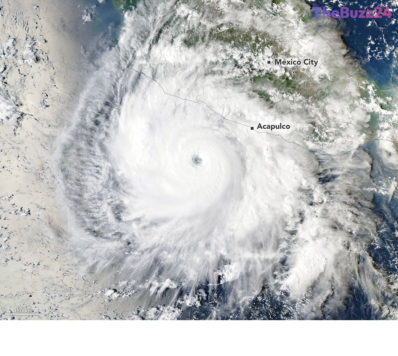
Hurricane Polo rapidly evolved from a modest tropical disturbance off Mexico’s Pacific coast into a catastrophic Category 5 storm, leaving weather experts astonished by its unprecedented growth rate. Developing in mid-September 2026, the system quickly organized into a tropical depression by September 20 and strengthened into a tropical storm shortly after.
What followed was a period of extreme rapid intensification that far exceeded standard meteorological expectations. Within a crucial 24-hour window ending on September 22, the hurricane’s maximum sustained winds surged by an extraordinary 90 knots, rocketing the system straight to Category 5 status. Research flights conducted by hurricane hunter aircraft estimated maximum winds reaching nearly 285 kilometers per hour, positioning Polo among the strongest storms recorded in the eastern Pacific and setting a new benchmark for the fastest transition from a tropical depression to a top-tier hurricane.
Atmospheric scientists point to a near-ideal combination of environmental factors that fueled the storm’s explosive growth. Weak wind shear, abundant atmospheric moisture, and high instability created prime conditions. Furthermore, the storm churned over ocean waters registering as high as 32 degrees Celsius—significantly warmer than typical September averages. Deep ocean heat content prevented the usual upwelling of cooler subsurface water, allowing Polo to maintain its immense power even as it underwent a brief eyewall replacement cycle.
While experts note that such extreme intensification events have historically occurred under various climate phases, the broader eastern Pacific season has experienced heightened activity, with accumulated cyclone energy nearly doubling seasonal norms. Forecasters continue to monitor Polo’s trajectory as it tracks over the Pacific, with potential paths bringing the dangerous system closer to the Baja California peninsula.
Key Takeaways
- Hurricane Polo underwent a record-breaking intensification, jumping to Category 5 strength after its winds increased by 90 knots in a single 24-hour period.
- The storm fed on exceptionally warm sea surface temperatures reaching up to 32 degrees Celsius and high subsurface ocean heat content.
- Experts emphasize that while individual intense storms occur across different climate cycles, eastern Pacific cyclone energy for the season has surged to nearly twice normal levels.
Editor’s Analysis & Impact
The rapid and extreme intensification of Hurricane Polo highlights the growing challenges meteorologists face in forecasting severe weather events amidst rising ocean temperatures. While scientists caution against directly tying a single storm to specific climate oscillations like El Niño, the broader trend of elevated accumulated cyclone energy in the eastern Pacific underscores a shifting baseline for tropical storm intensity. These anomalies stress the critical need for advanced satellite observation technologies and deep-water ocean monitoring systems. As storms increasingly leverage deep oceanic heat reservoirs to achieve unprecedented strengths rapidly, emergency management protocols and coastal infrastructure planning must adapt to shorter warning windows and more destructive potential impacts.
Frequently Asked Questions
Q: What is extreme rapid intensification in hurricanes?
A: It is a technical classification defined as a storm's maximum sustained wind speeds increasing by at least 60 knots within a 24-hour period. Hurricane Polo far exceeded this threshold by gaining 90 knots in a day.
Q: What factors caused Hurricane Polo to intensify so quickly?
A: Polo benefited from an optimal atmospheric environment featuring weak wind shear, high moisture, atmospheric instability, and unusually warm sea surface temperatures exceeding 32 degrees Celsius with deep ocean heat content.
Q: How does Hurricane Polo compare to historical storms?
A: With winds reaching nearly 285 kilometers per hour, Polo ranks as one of the strongest storms on record in the eastern Pacific by maximum sustained winds and broke records for the fastest escalation from a tropical depression to a Category 5 hurricane.
AI Disclosure: This article is based on verified data and official reports. Our Team and AI have cross-referenced every financial detail with primary sources to ensure total accuracy.
More from this Category