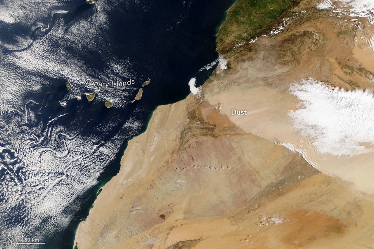
Massive Saharan Dust Storm Blankets Northwest Africa and Canary Islands
A powerful Harmattan dust storm swept across northwestern Africa on March 30, 2026, enveloping the region in a dense layer of Saharan sand and triggering immediate air quality concerns. The massive plume, which originated deep within the desert interior, tracked southwest, severely limiting visibility across Morocco before extending its reach over the Atlantic Ocean toward the Canary Islands.
Meteorological data indicates that the event was a classic ‘harmattan surge,’ intensified by robust ground-level winds linked to a passing cold front. As these winds collided with the High Atlas mountain range, the resulting atmospheric pressure forced the dense particulate matter to shift course, driving it aggressively toward the coastline. Satellite monitoring confirmed the rapid progression of the dust front throughout the day.
In the Canary Islands, residents prepared for the arrival of the phenomenon, locally referred to as ‘calima,’ which was forecasted to linger through April 1. Local authorities issued urgent safety warnings as air quality levels plummeted. This incident represents the second major dust event to strike the region this March, underscoring a seasonal pattern where early spring conditions frequently facilitate the transport of Saharan dust across both Mediterranean and Atlantic corridors.
Key Takeaways
- A major Harmattan dust surge impacted Northwest Africa and the Canary Islands starting March 30, 2026.
- The storm was caused by a cold front interacting with the High Atlas mountains, pushing dust into the Atlantic.
- Local authorities issued health warnings as the 'calima' event was expected to persist for several days.
Editor’s Analysis & Impact
The increasing frequency of intense Saharan dust events during the early spring highlights a growing volatility in North African weather patterns. These ‘calima’ events present multifaceted challenges, ranging from immediate public health risks due to poor air quality to economic disruptions in aviation and agriculture. The recurring nature of these surges suggests that the interaction between cold fronts and Saharan topography is creating more consistent transport corridors for particulate matter. As these plumes reach further into the Canary Islands and potentially Europe, there is a critical need for improved early-warning infrastructure and robust public health protocols. Future climate modeling will be essential to determine if these spring peaks are intensifying due to broader desertification and shifting wind patterns, which could necessitate long-term adjustments in regional disaster preparedness and environmental management strategies.
Frequently Asked Questions
Q: What is a Harmattan surge?
A: A Harmattan surge is a meteorological event characterized by strong, dry, dust-laden winds from the Sahara that are intensified by cold fronts, resulting in the large-scale movement of sand and dust across North Africa.
Q: What is 'calima'?
A: Calima is the local term used in the Canary Islands to describe the arrival of thick Saharan dust, which causes a significant reduction in visibility and a sharp decline in air quality.
AI Disclosure: This article is based on verified data and official reports. Our AI have cross-referenced every financial detail with primary sources to ensure total accuracy.
More from this Category