A Rare Orbital Perspective: San Francisco Captured from the International Space Station
On May 27, 2026, the San Francisco Bay Area experienced a brief reprieve from a period of unsettled weather, characterized by scattered showers and thunderstorms. As the clouds parted over the region that afternoon, the urban landscape of downtown San Francisco and its surrounding communities became clearly visible from low Earth orbit.
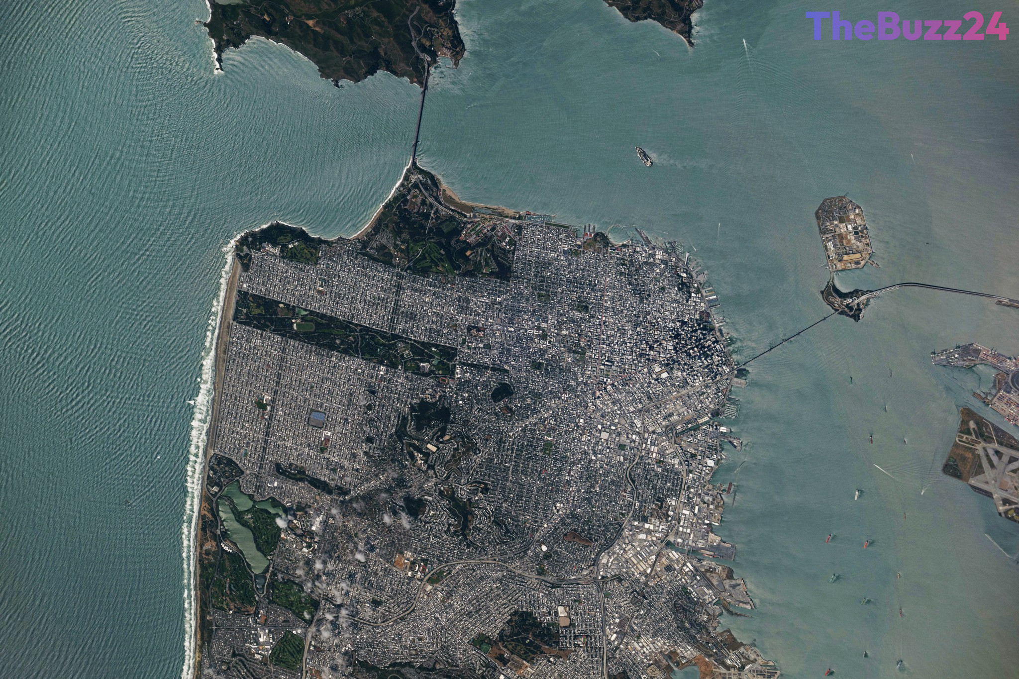
An astronaut stationed aboard the International Space Station utilized this window of clear weather to capture a high-resolution photograph of the peninsula. The image provides a distinct view of the region’s geography, highlighting the dense urban development of the city contrasted against the surrounding waters of the Pacific Ocean and the San Francisco Bay.
Prominently featured in the photograph are two of the region’s most recognizable landmarks. The Golden Gate Bridge is visible, serving as the vital link between the northern tip of the San Francisco Peninsula and Marin County. Simultaneously, the San Francisco-Oakland Bay Bridge is captured spanning the bay, illustrating the critical infrastructure connecting the city to Oakland and the East Bay.
Key Takeaways
- An astronaut aboard the International Space Station photographed San Francisco on May 27, 2026, following a period of stormy weather.
- The image clearly displays the Golden Gate Bridge and the San Francisco-Oakland Bay Bridge.
- The photograph highlights the unique geographical layout of the San Francisco Peninsula and its surrounding bay area.
Editor’s Analysis & Impact
The release of high-resolution imagery from the International Space Station serves as a powerful reminder of the intersection between human spaceflight and Earth observation. Beyond the aesthetic value, such imagery is critical for environmental monitoring and urban planning, providing a unique vantage point that ground-based sensors cannot replicate. As commercial space activity increases and satellite technology advances, the ability to capture real-time, high-fidelity data of urban centers will become increasingly vital for emergency management and climate tracking. This specific capture demonstrates how orbital assets can provide clear documentation of regional geography even in the wake of volatile weather patterns, reinforcing the importance of maintaining a robust presence in low Earth orbit for both scientific research and public engagement.
Frequently Asked Questions
Q: When was this photograph of San Francisco taken?
A: The photograph was taken on May 27, 2026, by an astronaut aboard the International Space Station.
Q: Which major bridges are visible in the image?
A: The image features the Golden Gate Bridge, which connects the peninsula to Marin County, and the San Francisco-Oakland Bay Bridge, which connects the city to Oakland.
AI Disclosure: This article is based on verified data and official reports. Our Team and AI have cross-referenced every financial detail with primary sources to ensure total accuracy.
More from this Category