NASA’s Monthly Satellite Image Challenge: Can You Identify This Earthly Enigma?
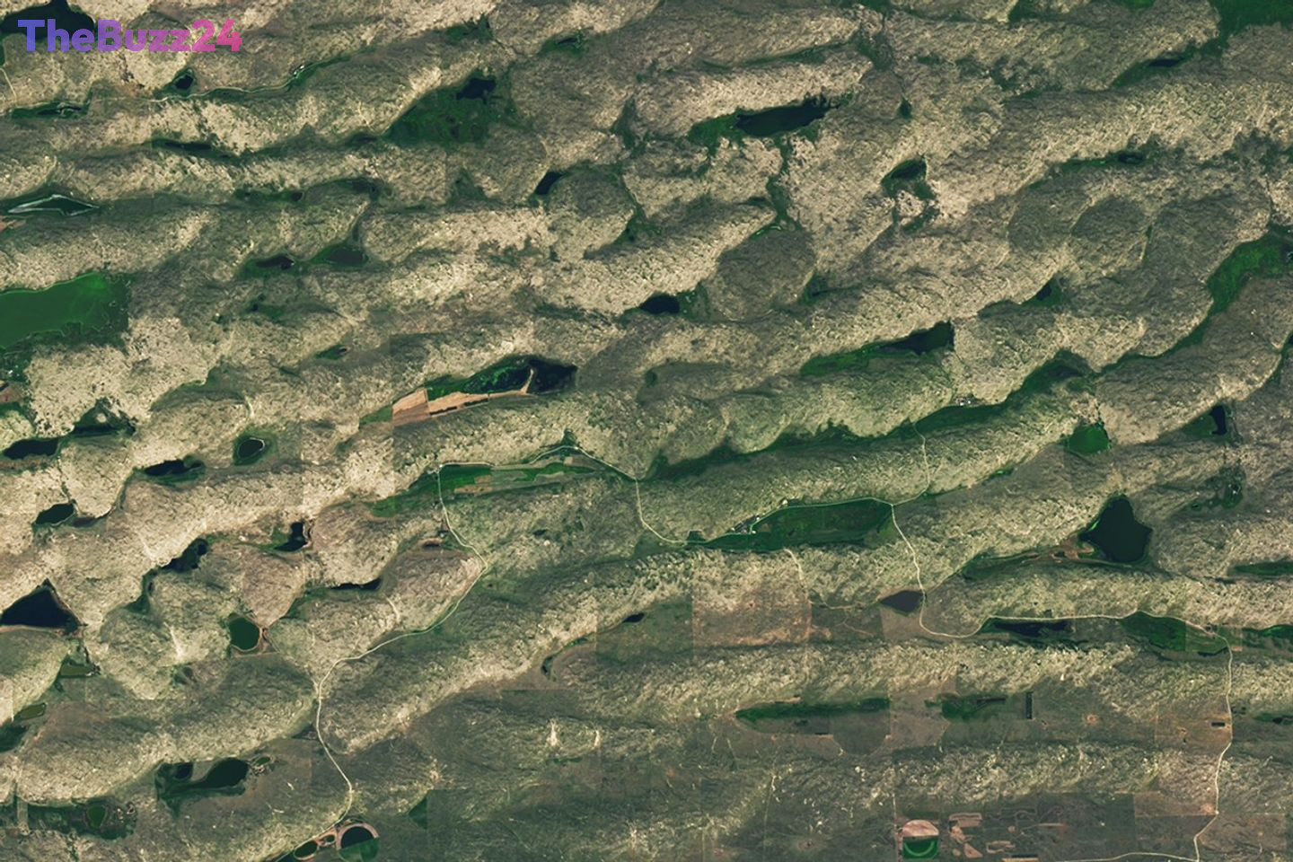
NASA’s Earth Observatory is once again inviting the public to test their geographical knowledge with its monthly satellite image puzzler. The latest challenge, released for June 2026, presents a captivating satellite view of an undisclosed location on Earth, prompting enthusiasts to identify its whereabouts.
Participants are encouraged to submit their guesses and observations through a dedicated online form. While a simple location guess is welcomed, the challenge offers an opportunity for deeper engagement. Aspiring geographers can earn recognition by identifying the specific satellite and instrument used to capture the image, detailing the spectral bands employed, or highlighting unique geological or historical features visible within the frame. Personal connections to the location, such as it being a hometown or a place of significance, are also encouraged.
Although the challenge does not offer monetary prizes or space travel, it provides the reward of “puzzler bragging rights.” Approximately one week after the submission deadline, NASA Earth Observatory will reveal the correct location at the top of its webpage. This reveal will be accompanied by a detailed explanation in an “Image of the Day” story, providing further insights into the featured landscape. The first individual to correctly identify the location will be publicly acknowledged, and particularly insightful or compelling responses may also be highlighted, fostering a sense of community and shared learning among Earth observation enthusiasts.
Key Takeaways
- NASA's Earth Observatory has launched its June 2026 satellite image challenge, asking the public to identify a mystery location.
- Participants can submit simple location guesses or more detailed observations about the image's origin and features.
- The first correct guess will receive 'bragging rights,' with the answer and detailed explanation to be published later.
Editor’s Analysis & Impact
This recurring challenge by NASA’s Earth Observatory serves as an effective and engaging tool for public outreach and education in Earth science and remote sensing. By gamifying the identification of geographical locations from satellite imagery, NASA fosters a deeper appreciation for the planet’s diverse landscapes and the technology used to observe them. The initiative not only tests geographical knowledge but also encourages critical observation skills and potentially sparks interest in fields like geography, environmental science, and aerospace technology. Its low-barrier entry, combined with opportunities for more in-depth participation, ensures broad appeal, reinforcing NASA’s mission to explore and understand our world.
Frequently Asked Questions
Q: What is the NASA Earth Observatory Puzzler?
A: The NASA Earth Observatory Puzzler is a monthly challenge where the public is presented with a satellite image and tasked with identifying the location it depicts. It's a way to engage people with Earth observation data and geography.
Q: Are there any prizes for correctly guessing the location?
A: While there are no monetary prizes or trips to space, the primary reward is 'puzzler bragging rights.' The first person to correctly identify the location is acknowledged, and the answer is revealed with a detailed explanation on the Earth Observatory website.
Q: How can I participate in the challenge?
A: You can participate by submitting your location guess and any additional observations through the dedicated form provided on the NASA Earth Observatory website, usually linked within the puzzler announcement.
AI Disclosure: This article is based on verified data and official reports. Our Team and AI have cross-referenced every financial detail with primary sources to ensure total accuracy.
More from this Category