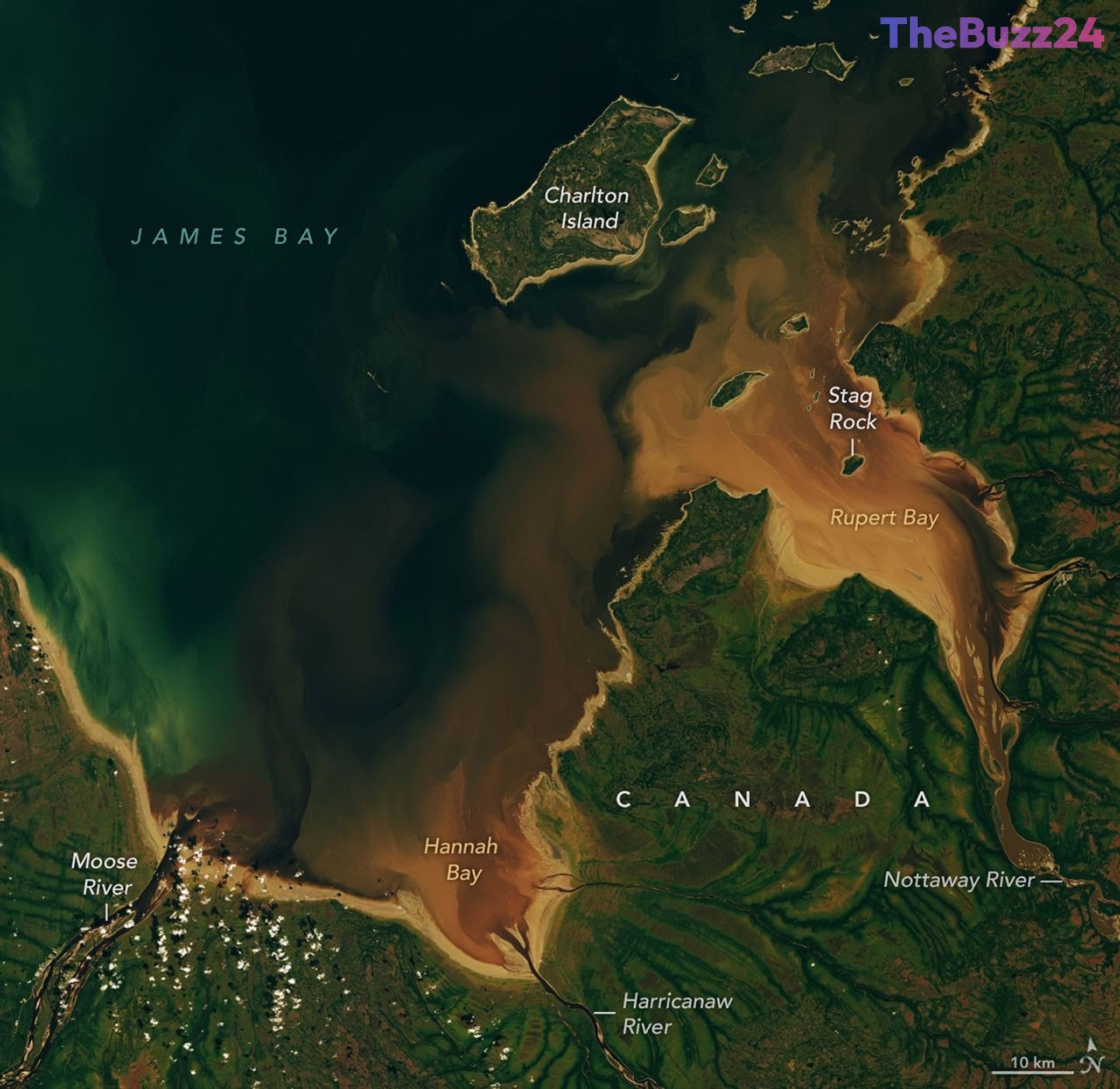
The Beaver Brown Waters of Canada’s Rupert and Hannah Bays Captured in Detail
Satellite imagery has highlighted the striking, tea-colored waters flowing into Rupert Bay and Hannah Bay in Canada, showcasing a natural phenomenon deeply tied to the region’s geography and history. Captured by advanced imaging technology in late September, the imagery reveals how rivers draining the boreal forests and bogs of northern Quebec and Ontario carry rich concentrations of colored dissolved organic matter (CDOM) directly into the southernmost extensions of James Bay.
This distinct brownish hue is caused by organic substances such as tannins and lignins, which leach from decaying leaves, roots, bark, and soils into local streams and rivers, much like how tea leaves steep in water. When these rivers—including the Moose, Nottaway, and Harricanaw—reach the broad mudflats of the bays, they mix with the darker blue waters of James Bay. The surrounding mudflats are shaped by shallow bathymetry and ongoing postglacial rebound, which slowly lifts the landscape while river currents continually deposit fine sediments.
The region’s landscape is also heavily influenced by ecological and historical factors. The vibrant green, vein-like patterns visible onshore illustrate the contrasts between dense forested growth along stream channels and the sparse vegetation of surrounding peat bogs. Furthermore, the area shares a profound historical connection with beavers, whose pelts drove the local fur trade centuries ago and inspired enduring indigenous mythology, including traditional tales about the creation of local geological landmarks like Stag Rock.
Key Takeaways
- Satellite imagery captured the distinct brown waters flowing into Rupert and Hannah Bays in northern Canada.
- The tea-like color is caused by colored dissolved organic matter (CDOM) leaching from decaying forest vegetation and soils.
- The region boasts a rich history tied to the historical fur trade and indigenous Cree mythology surrounding beavers.
Editor’s Analysis & Impact
The intersection of remote sensing technology and geographical documentation provides invaluable insights into northern wetland ecosystems. As climate patterns and hydrological cycles continue to shift, monitoring colored dissolved organic matter (CDOM) export from boreal forests into marine environments becomes increasingly critical for understanding broader carbon and nutrient cycling. Furthermore, these high-resolution Earth observation data products offer researchers a powerful tool to track landscape evolution driven by postglacial rebound and changing precipitation patterns. The long-term tracking of these watersheds not only aids ecological research but also preserves the rich historical and cultural narratives embedded within these unique northern landscapes.
Frequently Asked Questions
Q: Why do the waters of Rupert and Hannah Bays appear brown?
A: The brown color is caused by colored dissolved organic matter (CDOM), including tannins and lignins that leach from decaying leaves, roots, bark, and soils in the surrounding boreal forests and bogs.
Q: What rivers feed into Hannah and Rupert bays?
A: Major rivers flowing into these bays include the Moose, Nottaway, and Harricanaw rivers.
Q: What historical significance do beavers have in this region?
A: Beavers have played a central role in the region's history, serving as a primary resource for the historical fur trade established by European traders and the Hudson's Bay Company, as well as featuring prominently in local Cree mythology.
AI Disclosure: This article is based on verified data and official reports. Our Team and AI have cross-referenced every financial detail with primary sources to ensure total accuracy.
More from this Category