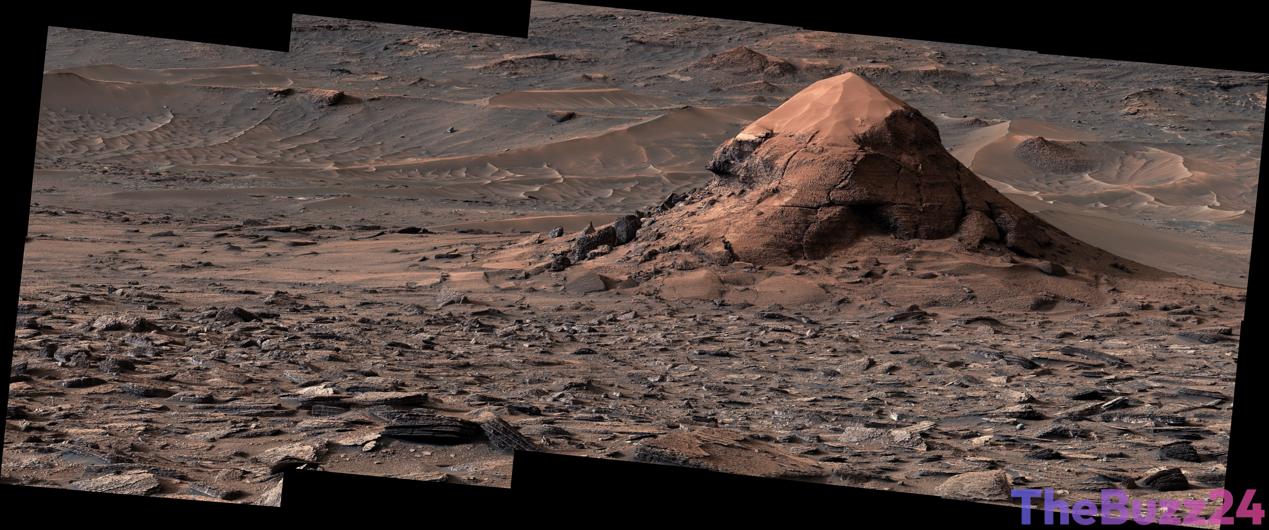
Curiosity Rover Captures Striking Sand-Capped Butte on Mars
NASA’s long-running Curiosity rover has returned a fascinating new panorama from the Martian surface, featuring a distinctive sand-capped geological formation. Known informally as “Miraflores,” the towering structure stands approximately 20 feet tall and offers researchers a unique look into the dynamic erosional history of the region. The feature was preserved as the surrounding landscape slowly wore away over extended periods, carving out the expansive valley the robotic explorer is currently navigating.
The detailed snapshot was captured by the rover’s Mast Camera on June 11, 2026, corresponding to the 4,923rd Martian day, or sol, of the ongoing mission. Alongside the prominent butte, the surrounding terrain reveals intricate surface features, including extensive polygonal patterns that provide further clues about the planet’s geological past and environmental evolution.
To create the expansive vista, scientists stitched together 11 individual frames transmitted back to Earth. Color balancing was applied to the mosaic to approximate the lighting conditions human observers would experience on Earth. The Curiosity mission continues to be managed by the Jet Propulsion Laboratory in Pasadena, California, with the Mastcam instrument operated by Malin Space Science Systems.
Key Takeaways
- The Curiosity rover captured a 20-foot-tall sand-capped butte nicknamed 'Miraflores' on Mars.
- The geological feature was left behind as surrounding rock eroded in the valley the rover is climbing.
- The newly released panorama consists of 11 stitched images with color-adjusted lighting to mimic Earth conditions.
Editor’s Analysis & Impact
The continuous operations of the Curiosity rover on Mars provide invaluable longitudinal data regarding planetary geology and the history of water and wind erosion on the Red Planet. Findings like the ‘Miraflores’ butte help scientists piece together how Martian landscapes evolved over millions of years, refining models of past climates. As robotic missions pave the way for future human exploration, the detailed mapping of terrain features, polygonal patterns, and stratigraphy remains critical for mission planning and exrobiology research.
Frequently Asked Questions
Q: What is the 'Miraflores' feature captured by Curiosity?
A: Miraflores is a sand-capped butte standing approximately 20 feet (6 meters) tall on Mars, formed as surrounding rock eroded over time.
Q: When was the photograph taken?
A: The image was captured on June 11, 2026, which marked the 4,923rd Martian day, or sol, of the Curiosity mission.
Q: How was the panoramic image created?
A: The panorama was made by combining 11 individual images sent back to Earth, with color adjustments made to reflect lighting conditions as a human eye would see them on Earth.
AI Disclosure: This article is based on verified data and official reports. Our Team and AI have cross-referenced every financial detail with primary sources to ensure total accuracy.
More from this Category