Curiosity Rover Uncovers Massive Field of Mysterious Martian Polygons
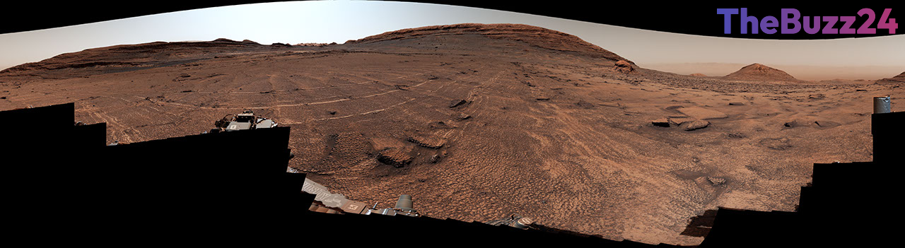
The Curiosity Mars rover has documented an expansive landscape characterized by a dense field of polygonal surface features, marking one of the most significant geological discoveries in the mission’s recent history. Captured during the 4,930th and 4,931st Martian days, the 360-degree panorama reveals a honeycomb-like terrain stretching across the foothills of Mount Sharp. These distinct shapes, measuring between two and four inches in diameter, appear to wrap around a prominent sand-capped butte known as Miraflores.
While the rover has encountered isolated polygonal patterns in previous years, the sheer concentration of these features in this specific region is unprecedented. The high-resolution imagery, composed of 340 individual frames stitched together by the Mast Camera, provides researchers with a detailed look at the Martian surface’s complex history. The color-corrected visuals allow scientists to better analyze the textures and spatial distribution of these formations.
Geologists are currently investigating the origins of these polygons, which are typically associated with environmental stress and sediment transformation. Potential formation theories include the drying of ancient mud, extreme temperature fluctuations, or the compaction of sediment following mineral changes or water loss. By studying these specific characteristics, the mission team hopes to unlock further clues regarding the environmental conditions that shaped the Martian landscape over millions of years.
Key Takeaways
- The Curiosity rover discovered an unusually dense field of polygonal surface features near Mount Sharp on Mars.
- The polygons range from 2 to 4 inches in diameter and exhibit a distinct honeycomb-like texture.
- Scientists are analyzing the formations to determine if they were caused by ancient mud drying, temperature cycles, or mineral-driven sediment shrinkage.
Editor’s Analysis & Impact
The discovery of such a concentrated field of polygons provides a critical data point for understanding the paleoclimatology of Mars. By identifying the specific mechanism behind these formations, researchers can better map the history of water and thermal stability in the region. This finding underscores the continued scientific value of the Curiosity mission as it traverses the foothills of Mount Sharp. Looking ahead, these geological markers serve as essential indicators for identifying potential sites of past habitability. As the rover continues its ascent, the ability to correlate these surface patterns with subsurface mineralogy will be vital for future Mars exploration strategies and the broader search for evidence of ancient life on the Red Planet.
Frequently Asked Questions
Q: What are the polygons found by the Curiosity rover?
A: They are small, honeycomb-like geometric shapes on the Martian surface, typically measuring 2 to 4 inches in diameter, likely formed by environmental processes like drying or temperature shifts.
Q: Why is this discovery significant?
A: While polygons have been seen before, the unprecedented density of these features in one location provides a unique opportunity for scientists to study the geological and environmental history of the area near Mount Sharp.
AI Disclosure: This article is based on verified data and official reports. Our Team and AI have cross-referenced every financial detail with primary sources to ensure total accuracy.
More from this Category