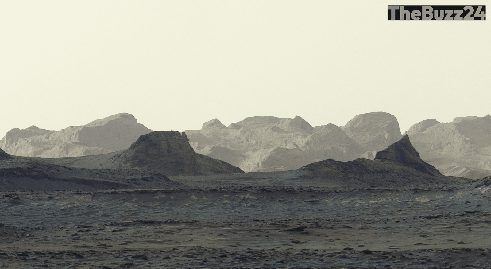
Curiosity Rover Reveals Unprecedented Detail of Martian Wind-Carved Landscapes
NASA’s Curiosity rover has provided a groundbreaking look at the Martian surface, capturing high-resolution imagery of wind-eroded geological formations known as yardangs. Released in early October 2026, the new panorama offers the most detailed perspective to date of distant cliffs that have been sculpted by the planet’s harsh atmospheric conditions over millions of years.
The images were acquired by the rover’s Mastcam on August 11, marking the 4,982nd Martian day, or sol, of the ongoing mission. By stitching together six individual high-definition frames transmitted back to Earth, mission scientists have successfully mapped the intricate textures of these elongated ridges, providing a clearer understanding of the geological history of the region.
These findings represent a significant milestone for the Curiosity team, who have long sought to examine these specific wind-carved features at close range. The data gathered from this panorama is expected to assist researchers in better interpreting the environmental shifts that have shaped the Martian landscape, offering new insights into the planet’s complex geological evolution.
Key Takeaways
- The Curiosity rover captured a high-resolution panorama of yardangs, which are ridges formed by long-term wind erosion on Mars.
- The imagery was compiled from six separate photos taken on the 4,982nd sol of the mission.
- This data provides scientists with the most detailed view yet of Martian cliffs, aiding in the study of the planet's geological history.
Editor’s Analysis & Impact
The successful capture of these high-resolution images underscores the enduring utility of the Curiosity rover, which continues to provide critical scientific data well beyond its initial mission parameters. By focusing on yardangs, researchers are gaining a deeper understanding of aeolian processes on Mars, which is essential for modeling the planet’s past climate and surface stability. This mission longevity highlights the robustness of current robotic exploration technology and sets a precedent for future surface missions. As we look toward potential human exploration, these detailed topographical maps are vital for identifying safe landing zones and understanding the environmental hazards posed by Martian terrain. The ability to remotely analyze such fine-scale geological features remains a cornerstone of planetary science, bridging the gap between orbital observations and ground-level reality.
Frequently Asked Questions
Q: What are yardangs?
A: Yardangs are elongated, streamlined ridges or hills carved into rock by the abrasive action of wind-blown sand and dust.
Q: How long has the Curiosity rover been on Mars?
A: As of the data provided, the rover has been operating on the Martian surface for over 4,982 sols, which is equivalent to more than 13 Earth years.
AI Disclosure: This article is based on verified data and official reports. Our Team and AI have cross-referenced every financial detail with primary sources to ensure total accuracy.
More from this Category