Decoding the Sky: How Earth’s Weather Impacts the Final Frontier
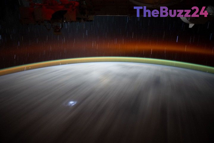
The Atmospheric Waves Experiment (AWE) has successfully wrapped up its 30-month tenure aboard the International Space Station, fundamentally changing our understanding of how terrestrial weather influences the space environment. By utilizing advanced sensors to track ‘airglow’—faint bands of light in the upper atmosphere—the mission mapped the movement of atmospheric gravity waves. These invisible ripples, triggered by surface phenomena like mountain winds, hurricanes, and tornadoes, travel upward to create significant disturbances in the upper reaches of the atmosphere.
Throughout its time in orbit, the AWE mission generated a massive archive containing more than 80 million infrared images. This data has enabled researchers to establish a clear link between extreme weather events on the ground, such as the 2024 tornado season and Hurricane Helene, and measurable changes in the upper atmosphere. These gravity waves are more than just a scientific phenomenon; they have the capacity to alter plasma density, which directly affects the performance of GPS navigation, satellite communications, and the precision timing systems that underpin the global economy.
Following the conclusion of its mission, the AWE hardware is being decommissioned to clear space for the upcoming CLARREO Pathfinder project. Although the physical instrument is being removed, its extensive dataset remains available to the public. This archive serves as a critical resource for both professional scientists and the public, providing a new framework for understanding how Earth’s climate dynamics interact with the orbital environment that is increasingly vital to modern human activity.
Key Takeaways
- The AWE mission successfully mapped how terrestrial weather events like hurricanes create gravity waves that reach the upper atmosphere.
- These atmospheric disturbances can disrupt satellite communications, navigation, and timing systems critical to global infrastructure.
- The mission collected over 80 million infrared images, which are now available to the public for further scientific study.
Editor’s Analysis & Impact
The completion of the AWE mission marks a significant milestone in our understanding of the ‘space-weather’ continuum. Historically, terrestrial weather and space weather were treated as distinct domains; however, this data confirms that the Earth’s atmosphere is a highly coupled system. For the aerospace and telecommunications industries, these findings are critical. As we become increasingly reliant on low-Earth orbit (LEO) constellations for internet and navigation, understanding the atmospheric ‘noise’ generated by ground-level weather is essential for satellite resilience. Future mission designs will likely incorporate this data to better predict signal interference, potentially leading to more robust satellite shielding and communication protocols. This research effectively bridges the gap between meteorology and orbital mechanics, setting a new standard for how we monitor the health of our near-space environment.
Frequently Asked Questions
Q: What are atmospheric gravity waves?
A: Atmospheric gravity waves are ripples in the air caused by the displacement of air masses, such as wind moving over mountains or intense weather systems like hurricanes, which then propagate upward into the upper atmosphere.
Q: Why does terrestrial weather affect satellite communications?
A: Gravity waves from Earth's weather can alter the density of plasma in the upper atmosphere. Changes in plasma density can interfere with radio signals, leading to disruptions in satellite communications and GPS navigation.
AI Disclosure: This article is based on verified data and official reports. Our Team and AI have cross-referenced every financial detail with primary sources to ensure total accuracy.
More from this Category