Curiosity Rover Uncovers Mysterious Polygonal Terrain on Mars
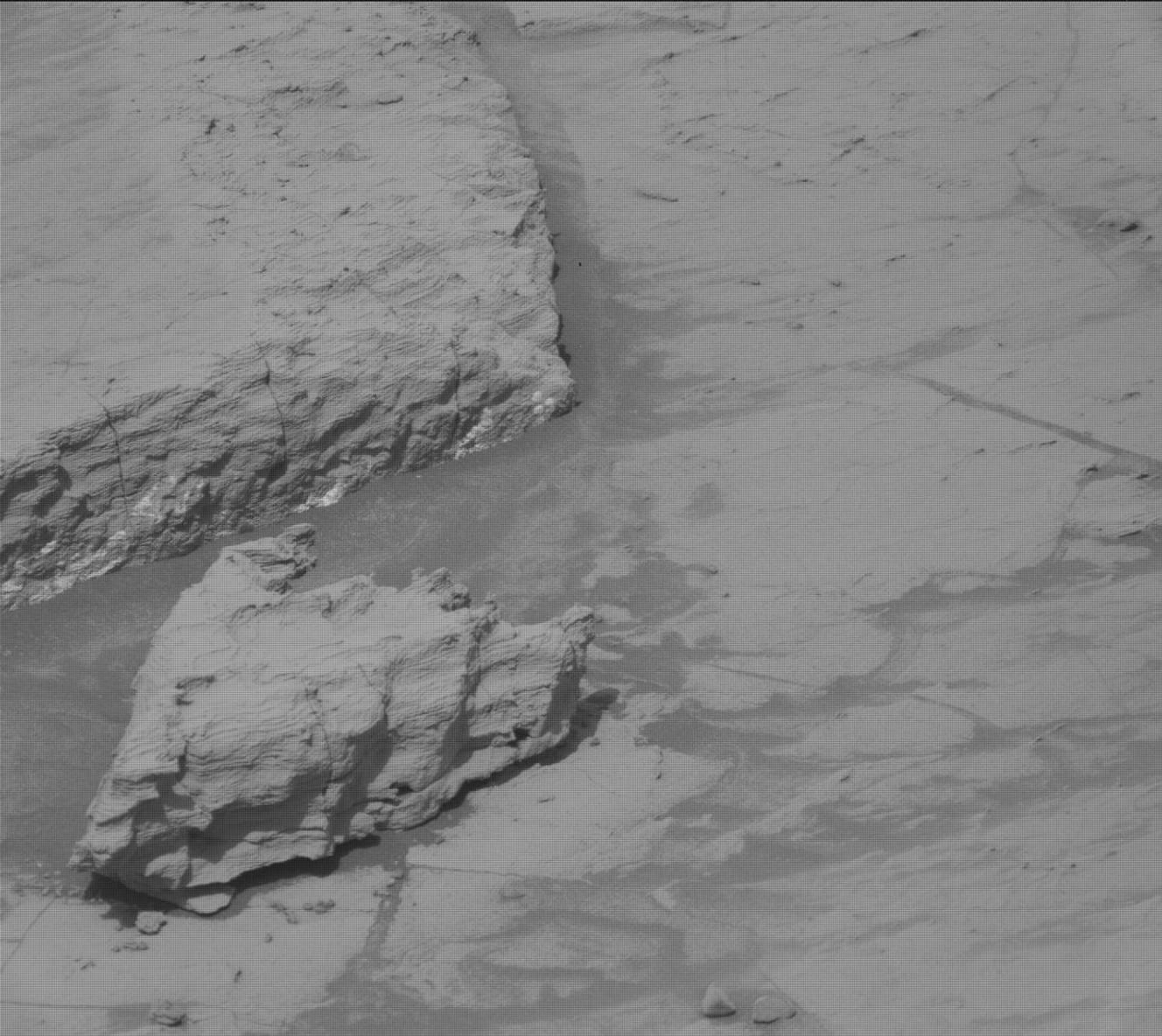
The Mars Curiosity rover has encountered a unique and rugged landscape as it continues its mission on the Red Planet. During recent operations, the rover navigated into a region defined by dense clusters of rock blocks, many of which exhibit distinct polygonal patterns. This geological formation bears a striking resemblance to boulder-rich areas previously identified near the margins of the Gediz Vallis Channel, prompting scientists to prioritize a detailed investigation of the site.
To maintain scientific momentum, the mission team utilized the rover’s autonomous capabilities, including the AEGIS self-targeting system, to conduct measurements even when communication delays occurred. This agile approach allowed the rover to continue its environmental monitoring, including dust-devil tracking and atmospheric opacity measurements, while ensuring that high-priority geological targets were not missed. The team also executed a ‘MARDI sidewalk’ maneuver, capturing high-resolution imagery during the rover’s drive to better understand the transition of the terrain.
Central to the current phase of the mission is the chemical analysis of these polygonal features. The rover is employing its ChemCam and APXS instruments to examine specific targets such as ‘Las Petas’ and ‘Los Condores.’ By comparing the chemical composition of the bedrock with these unique formations, researchers hope to decode the environmental history of the region. These efforts are further supported by long-distance imaging of geological structures like the ‘Mishe Mokwa’ butte, providing a comprehensive view of the Martian surface as the rover continues its ascent of Mount Sharp.
Key Takeaways
- Curiosity has discovered a new region characterized by rugged, polygonal rock patterns similar to those found near the Gediz Vallis Channel.
- The mission team successfully used autonomous systems like AEGIS to continue scientific operations despite temporary communication delays.
- Researchers are using chemical analysis and high-resolution imaging to determine how these polygonal formations were created and what they reveal about Mars' past environment.
Editor’s Analysis & Impact
The ongoing investigation by the Curiosity rover into the polygonal terrain of Mars represents a critical step in understanding the planet’s geological evolution. By analyzing the chemical composition of these unique structures, scientists are essentially reading the ‘geological record’ of Mars, which could provide evidence of past water activity or climate shifts. The successful implementation of autonomous targeting systems during communication gaps highlights a significant advancement in space exploration technology, allowing for greater mission efficiency. As Curiosity continues its ascent of Mount Sharp, the data gathered from these diverse formations will be instrumental in refining models of Martian environmental history. This mission continues to demonstrate that even after years of operation, the rover remains a vital asset for uncovering the complex, hidden history of our neighboring planet.
Frequently Asked Questions
Q: What are the polygonal patterns found by the Curiosity rover?
A: These are distinct, geometric rock formations that suggest specific geological processes, such as thermal contraction or desiccation, occurred in the Martian past.
Q: How does the rover continue to work during communication delays?
A: The rover utilizes autonomous systems like AEGIS, which allows it to identify and analyze interesting geological targets using its onboard instruments without needing real-time instructions from Earth.
AI Disclosure: This article is based on verified data and official reports. Our AI have cross-referenced every financial detail with primary sources to ensure total accuracy.
More from this Category