Rare Snowfall Blankets Patagonian Desert in Unprecedented Weather Event
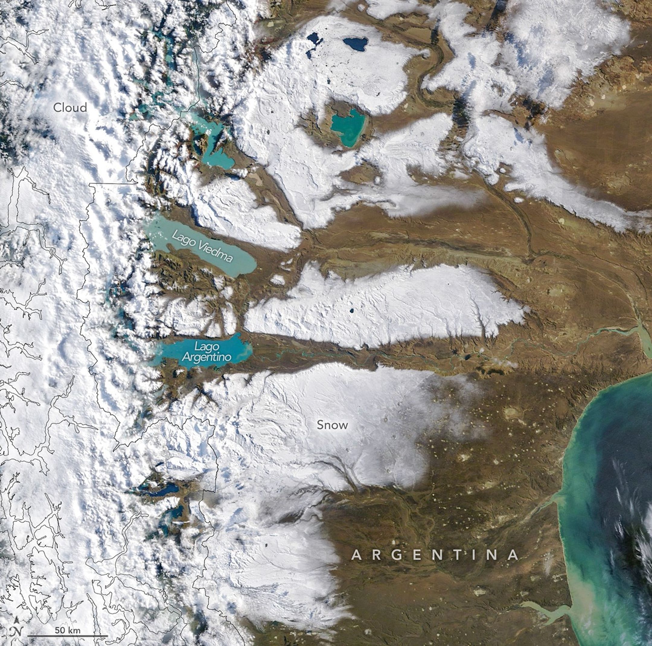
The arid plains of southern Argentina underwent a dramatic and unexpected transformation in early April 2026, as a rare weather system deposited a thick layer of snow across the typically dry Patagonian desert. Satellite imagery captured the striking sight of a vast, white landscape covering regions that rarely experience such wintry conditions during the transition into the autumn season.
Atmospheric scientists have identified a period of unusually high moisture levels throughout late March and early April as the primary catalyst for the event. While the Andes Mountains generally act as a formidable barrier to precipitation, intense wind patterns successfully forced the storm system eastward. This allowed significant snowfall to penetrate deep into the Argentinian plains, creating a sharp visual contrast against the region’s characteristic desert topography.
Despite the intensity of the storm, the snow cover was remarkably short-lived. Meteorological data confirmed that the vast majority of the accumulation had melted by the afternoon of April 4, leaving only the highest mountain peaks with a light dusting. This rapid transition highlights the volatile nature of weather patterns in one of the world’s most unique and arid environments, serving as a reminder of how quickly local climates can shift.
Key Takeaways
- An unseasonal storm brought rare, widespread snowfall to the arid Patagonian Desert in April 2026.
- Strong wind patterns were the primary driver, allowing moisture to bypass the Andean mountain barrier.
- The snow cover was short-lived, with most of the accumulation melting within 24 hours.
Editor’s Analysis & Impact
The sudden, albeit brief, snowfall in the Patagonian Desert serves as a poignant reminder of the increasing volatility in regional climate patterns. While isolated weather events are common, the shifting moisture transport mechanisms—driven by changing wind patterns and atmospheric humidity—suggest that even the most arid regions are susceptible to rapid, extreme shifts. From an environmental perspective, these events are critical for researchers studying glacial flour and sediment transport in glacial lakes. As global climate models continue to evolve, the ability to track these transient events via satellite imagery becomes essential for understanding long-term ecological impacts on desert biomes. Future outlooks suggest that while these events may remain rare, their occurrence provides valuable data on the interaction between Andean topography and shifting atmospheric moisture currents.
Frequently Asked Questions
Q: Why is the snow in Patagonia considered unusual for early April?
A: The Patagonian Desert is characterized by an arid, dry climate. Early April marks the beginning of autumn, a time when widespread snow cover across the plains is historically rare.
Q: Why do the lakes in Patagonia appear milky blue or turquoise?
A: The distinct color is caused by 'glacial flour,' which consists of fine sediment pulverized by glaciers and suspended in the water of the region's large glacial lakes.
AI Disclosure: This article is based on verified data and official reports. Our AI have cross-referenced every financial detail with primary sources to ensure total accuracy.
More from this Category